


San Antonio air quality map
Live air pollution map of San Antonio • 77.6K Followers • 03:00, Oct 17 Local time


Stations
Clean Air Facilities
Contributors

Government
1
Diplomatic
0
Non-profit
0
Education
0
Corporate
0
Healthcare
0
Hospitality
0
Individual
33Top contributors in San Antonio
Who is sharing outdoor air quality data in San Antonio?
Featured station
Discover some of the best station installation in San Antonio
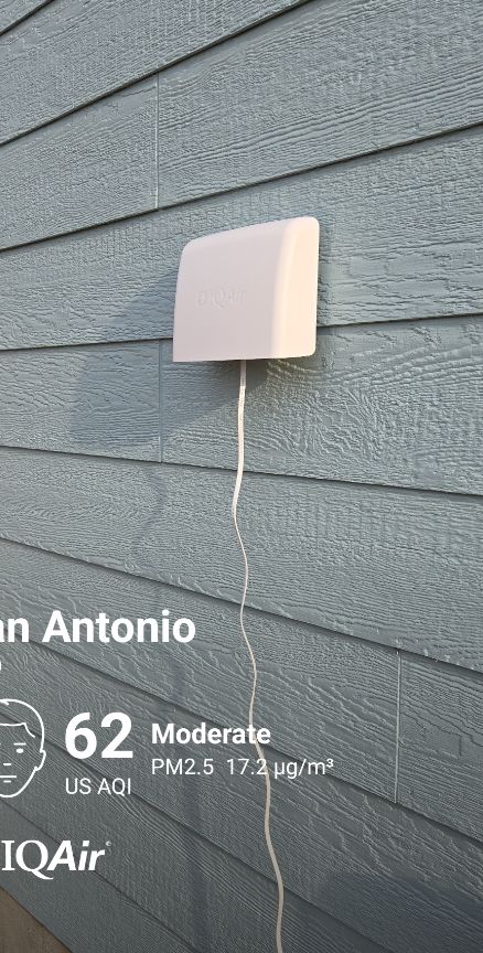

Station gallery

Crescent Hills, San Antonio
6
Newest stations deployed in San Antonio
AQI⁺ station ranking
Newest stations




Learn more about global air quality


Learn more about air pollution in San Antonio
What is the air quality in San Antonio?
San Antonio's annual air quality averages a US air quality index, or AQI, of “good.” In 2019, monthly averages ranged from AQI 25 (“good”) in October to AQI 54 (“moderate”) in May. Spring and summer tend to be more polluted than the fall and winter. May, July, and June were San Antonio’s most polluted months, respectively, with average AQIs of 54, 44, and 43. For further data regarding 2020 readings, please refer to the 'recent pollution levels' question as shown below in the text.
Despite clean annual averages, daily fluctuations can contribute to unhealthy pollution events. The San Antonio area had 49 days of unhealthy, ‘nonattainment’ air pollution in 2018.1 Unhealthy days are defined as days in which either PM2.5 or ozone levels exceeded the federal threshold for 8-hour pollution. Most often, unhealthy days were the result of high ozone.
Ozone is a gas molecule, described as ‘smog’ at ground-level. Unlike most pollutants, ozone is not emitted directly into the atmosphere but rather is formed in the air from precursor pollutants reacting in sunlight. This property makes ozone more difficult to control and regulate, particularly in warm urban environments that have ideal conditions for ozone formation.
In 2019, San Antonio was rated an “F” for ozone pollution according to the American Lung Association’s State of the Air report.2 The city moreover ranked 38th for high ozone nationally out of 229 included metropolitan areas. A 2017 study prepared for the City of San Antonio by environmental consulting group Ramboll Environ examined city health data from 2010 to 2014, concluding that nearly 4,700 residents died due to respiratory diseases during that four-year period.3 The study authors suggest that current ozone levels (~73 ppm) may contribute to deaths from respiratory illness, indicating that a further rise in ozone to 80 ppm could result in even higher mortality. Improving ozone levels to less than 68 ppm could save roughly 24 lives per year. Conversely, should ozone levels deteriorate to 77 ppm, it is estimated that an additional 19 deaths could result annually.
Follow live air quality data in San Antonio at the top of this page, and use San Antonio’s forecast air quality data to plan ahead and take precautionary measures to reduce your pollution exposure.
What is polluting the air in San Antonio?
In recent years, San Antonio’s air quality has worsened. This comes despite long-term improvements since the Clean Air Act of 1970.
For fine particulate matter, or PM2.5, San Antonio experienced a 17.5% increase in pollution levels from 2018 to 2019. San Antonio’s recent air pollution jumps may be attributable to fracking at the relatively new Eagle Ford shale facility 50 miles from the city as well as to a drastic increase in illegal air pollution from nearby industrial facilities.4
According to a study published by Environment Texas and Frontier Group, Texas industrial facilities reportedly released 135 million pounds of illegal air pollution in 2018, or more than double the amount from the previous year. Weak penalties and enforcement are likely to have directly incentivized these increases. The penalties for illegal emissions from all Texas facilities only amounted to $2 million in 2018, or roughly one cent per pound of illegal air pollution. That number is less than 1/100th of what they could have charged ($297 million) under existing law. Texas’s business-first approach, in the face of resident health, presents a significant challenge to tackling air pollution levels in the state and in San Antonio specifically.
Fracking is also thought to have increased city-wide ozone levels. Since Eagle Ford shale, one of the nation's largest oil and gas developments, was established just outside of the city, ozone levels have increased significantly.5 Data collected by InsideClimate News found that during the months of April to October, the months in which San Antonio’s ozone levels were the highest, oil and gas development accounted for half of all ozone-forming precursor pollutants in the atmosphere.
Many health and environmental experts advocate that the current federal ozone standard of 70 ppb doesn't do enough to safeguard public health. There is pressure for the EPA to further lower the standard to around 60 ppb. As San Antonio continues to fail the present 70 ppb standard, and air pollution levels appear to be on the rise, it is clear that more must be done to reduce emissions from the largest polluting sources: transportation and the oil and gas industry.
Is the pollution level a problem in San Antonio?
Transportation remains the leading source of air pollution in San Antonio. According to a report from Frontier Group and the Environment America Research & Policy Center, it is estimated that more than half (52%) of all PM2.5 and ozone pollution in Texas originates from transportation exhaust. San Antonio is a relatively dispersed city in Bexar county. The area is home to more than 2 million residents and 1.6 million registered vehicles.6 According to the 2017 census, nearly 80 percent of workers in San Antonio drive to work every day by themselves.7 The average commute was 24 minutes, or 48 minutes to work and back.
In an effort to reduce transportation emissions, San Antonio’s EV-SA has been established to plan efforts around electric transportation. The city currently offers a $2,500 rebate incentive for consumer electric vehicles and further allows electric vehicle owners to park for free at city managed street parking meters.8 San Antonio is further attempting to “lead by example” in transitioning 85 percent of the city’s administrative vehicles to electric, hybrid, and fuel-efficient vehicles by 2020.
Petroleum-related industrial activity accounts for the next largest portion of PM2.5 and ozone, giving rise to roughly 21% to state’s pollution.9 Emissions in this sector have continually exceeded regulations, with very little penalty and enforcement. From 2017 to 2018 alone, emissions from petroleum activity in Texas doubled. Fines have not been charged to the fullest extent of the law, making it in a petroleum business’ best interest to over-pollute.
Geographically, San Antonio is located in a valley. Weather tends to move winds from the southeast to the northwest, bringing Gulf air to the city.7 These events can contribute to temperature inversions, a phenomenon in which warm air above traps cooler air below, contributing to an accumulation of surface air pollution. While many cooler locations commonly experience inversion patterns in the winter, this weather event is much more common during the summer in San Antonio.
Surprisingly, the majority of San Antonio’s air pollution comes from locations outside of the city limit, according to the Alamo Area Council of Governments (AACOG).10 Roughly 16 percent is estimated to come from the rest of the U.S. (including other parts of Texas), while another 25 percent comes from the rest of North America. According to this report, the largest portion, 38 percent, is from other global locations outside of North America. In order for San Antonio to attain federally mandated pollution levels, significant changes must be made to its own city-wide emissions, which contribute 20.5 percent of air pollution. Such regulations must focus on cleaner energy, especially in the transportation sector, and on stricter emission regulations of surrounding industrial businesses.
San Antonio’s AQI can vary from location to location, even within the city. Use San Antonio’s air pollution map to understand the impact of local emission sources.
What are the recent pollution levels in San Antonio?
With data from 2020 now available, there is much more information online regarding the quality of the air in San Antonio. It can be seen that there was an improvement in the air quality readings, with the PM2.5 count having dropped. Whilst this was not a massive improvement, it is still a step in the right direction, and any drop in pollution levels is an extremely positive factor. In 2019 the overall PM2.5 reading was 9.4 μg/m³, still within the World Health Organizations (WHO's) target bracket of 10 μg/m³ or less for the best quality of air.
This was followed in 2020 with a reading of 8.9 μg/m³, an improvement of 0.5 units and further into the WHO's target goal. Whilst a reading of 10 μg/m³ or less is required, the closer to 0 the number approaches, the more optimal the quality of air is, with some of the cleanest cities or islands around the world (with very little anthropogenic or industrial activity taking place) having readings of around 1 to 2 μg/m³, indicating extremely clean and fresh air, free from many of the chemical compounds and hazardous particulate matter that plagues cities throughout the United States and indeed the rest of the world.
However, when looking back even further, it can be seen that the reading taken in 2020 was actually worse than both 2018 and 2017, which is indicative that San Antonio may just be experiencing fluctuating pollution levels that typically hover around the same number year in year out. It may take a concentrated effort in the coming years to truly see this number be reduced and reach even more appreciable levels.
When is the air quality level in San Antonio at its cleanest?
Observing the data collected over 2020, it can be seen that there were two different ratings over the months of the year, with seven months coming in within the WHO's target goal, and the remaining five coming in with a ‘good’ air quality rating, which requires a PM2.5 reading of 10 to 12 μg/m³ to be classified as such, a ratings group with a very fine margin of entry.
Addressing the ones that were more polluted first, the months of March and April, June and July as well as September all came in with ‘good’ ratings of air pollution. They had readings of 10.8 μg/m³, 10.3 μg/m³, 10.2 μg/m³, 10.7 μg/m³ and 10.3 μg/m³ respectively, making March the most polluted month out of the entire year with its reading of 10.8 μg/m³.
Moving onto the cleaner months, January and February, May, August as well as October through to December all fell within the WHO's target bracket, with their own respective readings of 7.1 μg/m³ for both January and February, 8.7 μg/m³, 8.8 μg/m³, 8.6 μg/m³, 7.1 μg/m³ and 7.3 μg/m³, making January, February and November joint for the cleanest month of the year with their readings of 7.1 μg/m³. If San Antonio were able to maintain these cleaner readings throughout the year then its average reading could be improved significantly, as well as its world ranking.
What are some of the main pollutants found in the air in San Antonio?
With some of the more serious pollutants such as ozone already having been touched on, it stands to reason that in a majority of cities, including San Antonio, there are many other chemical compounds and particulate matter floating around in the air, driving up the PM2.5 count and making the air riskier to breathe, particularly in certain pollution hotspots.
These would be ones such as black carbon and volatile organic compounds (VOCs), both of which are formed from the incomplete combustion of both fossil fuels and organic material. As such, they can find their creation from vehicle engines, factory or power plant boilers, as well as forest fires or even firewood and charcoal being burnt in people’s homes. Black carbon is the main component of soot, and can often be found caked on roadside areas that see a high volume of traffic.
It is a highly dangerous material when respired, being both carcinogenic as well as belonging to the PM2.5 collective, being small enough to enter into one’s blood stream upon respiration, due to its insidiously small size allowing it to enter the lungs and cross over the blood barrier. Once in the bloodstream it can cause all manner of health issues to arise, as would be expected from a foreign material being circulated around the body.
Some examples of the aforementioned VOCs include chemicals such as benzene (also highly carcinogenic), toluene, xylene, methylene chloride and formaldehyde. Of note is that VOCs are major contributors to indoor pollution as well, often found emanating from products such as paints, preservatives, aerosols and air fresheners, as well as any items containing adhesives or certain glues. As such one should be wary to reduce the use of possible indoor contaminants, as they can have adverse effects on health when respired over long periods of time. Other pollutants of prominence include both sulfur dioxide (SO2) and nitrogen dioxide (NO2), both of which are formed mainly from vehicles, with NO2 being the chief offender here when it comes to vehicular emissions.
+ Article Resources
[1] Environment Texas Research and Policy Center. (2020). Trouble in the air millions of Americans breathed polluted air in 2018.
[2] American Lung Association. (2020). State of the air – 2019.
[3] Palacios J. (2017). Deteriorating air quality in San Antonio could mean more respiratory deaths. Texas Public Radio.
[4] Nowlin S. (2019). Illegal air pollution has increased exponentially in the San Antonio area, according to new report. San Antonio Current.
[5] Song L. (2013, October 23). What's behind surging ozone pollution in Texas? Study to weigh role of fracking in health hazard. Inside Climate News
[6] San Antonio District statistics: vehicles registered. (2019). Texas Department of Transportation.
[7] Hardin W. (2019). The air you breathe: San Antonio’s air quality & helping kids with asthma.
[8] City of San Antonio. (2020). Electric vehicles San Antonio.
[9] Ridlington E., et al. (2020). Trouble in the air: millions of Americans breathed polluted air in 2018.
[10] Friedman C. (2018). Most of San Antonio's air pollution comes from other cities, countries, AACOG says.
Where is the cleanest air quality in San Antonio?
- San Antonio Old Hwy90 C6777
- River North Drive 112
- Crescent Hills17
- 2001-2299 Beechaven Dr18
- 299-207 E Huff Ave18
- Greystone Ridge18
- 1318-1300 Snyder St19
- 1516-1000 S Elmendorf St19
- 1898-1816 El Paso St19
- 198-114 Grosvenor Blvd19
- 205 Hot Wells Blvd19
- Oakmont Ct.19
- 1601-1611 Saunders Ave20
- 2312 Pleasanton Rd20
- 398-300 Walton Ave20
- Trenton St20
- 163-111 Da Foste Ave21
- 2094-2000 W Cesar E Chavez Blvd21
- 607 Montezuma St21
- 66 Service Rd21
- 6698-6600 Curtis St21
- Guadalupe Westside21
- Midtown21
- Olmos Park Terrace21
- Support Services Facility F21
- 2398-2300 S Trinity St22
- 2720 Vera Cruz22
- San Antonio Bulverde Parkway C108722
- 400-528 E Pyron Ave23
- SouthSan Community Center23
- CPS Pecan Valley24
- 417-435 N Park Blvd26
- 743 SW Military Dr26
- 300-374 Sussex Ave28
- South San Antonio34
- Harlandale The Pantry42



