
Bend air quality map
Live air pollution map of Bend • 281.5K Followers • 06:00, Aug 02 Local time


Stations
Clean Air Facilities
Contributors
Government
1Diplomatic
0Non-profit
0Education
2Corporate
1Healthcare
0Hospitality
1Individual
79Top contributors in Bend
Who is sharing outdoor air quality data in Bend?
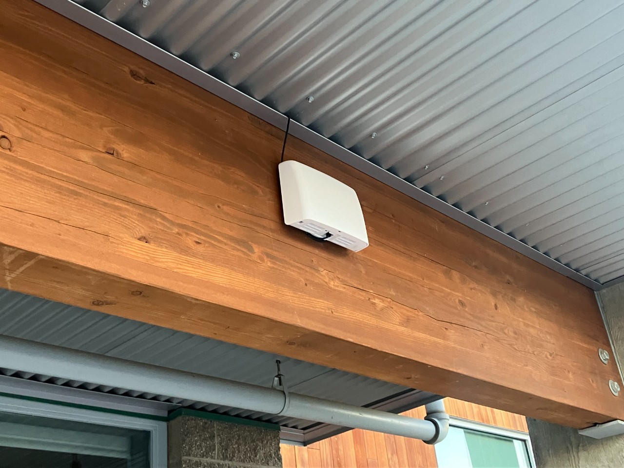
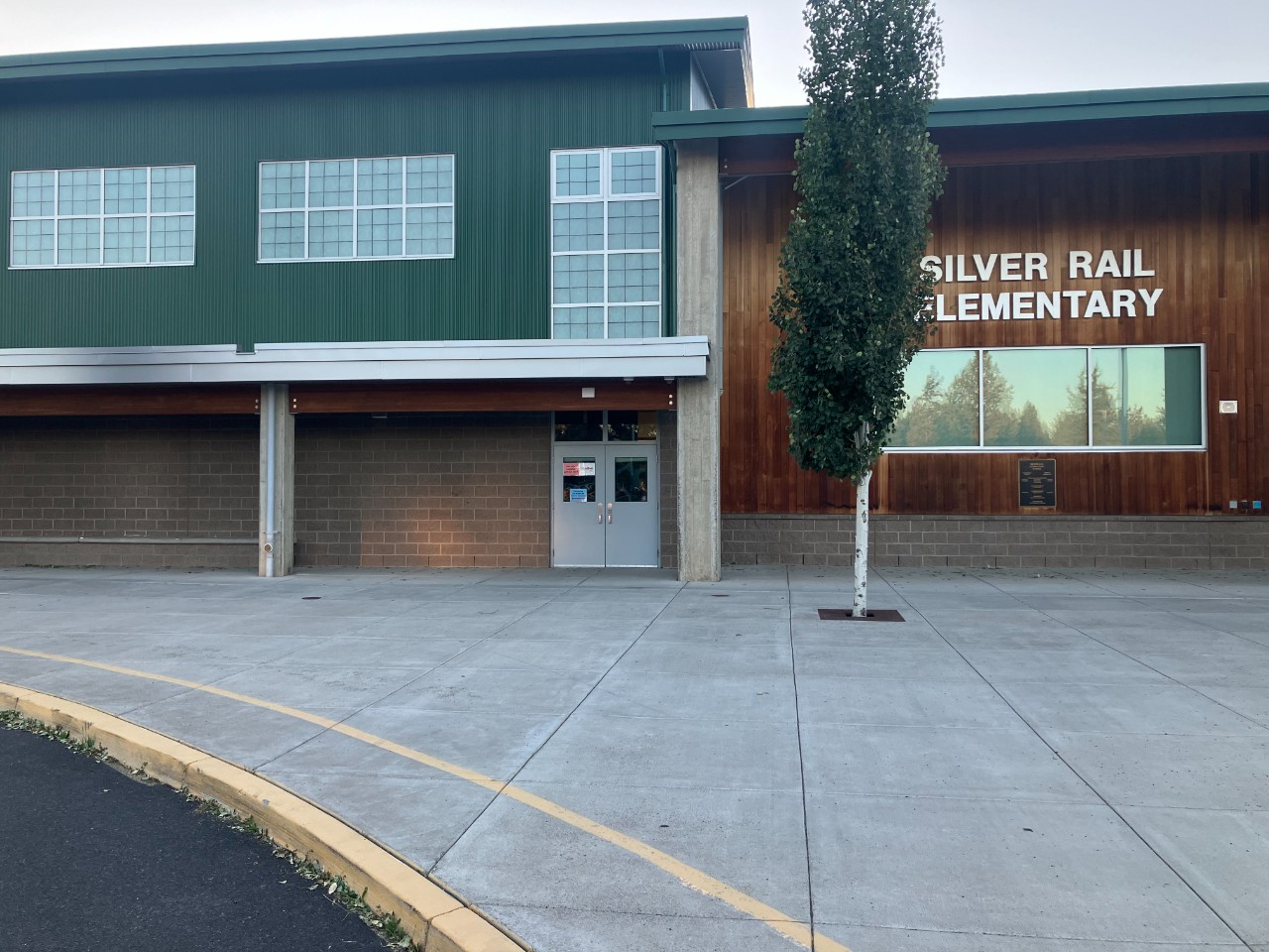
Featured station
Discover some of the best station installation in Bend
Station gallery

Silver Rail Elementary School, Bend
6
Newest stations deployed in Bend
AQI⁺ station rankingNewest stations


Learn more about global air quality


Learn more about air pollution in Bend
What is the present level of air pollution in Bend city, Oregon?
Bend is a city in and the county seat of Deschutes County, Oregon. According to a 2010 census, Bend had a population of approximately 77,000 people, which was an increase of 25,000 over the 2000 figure. However, in 2019, the estimated population was closer to 197,500 people. This made it the 5th largest metro area in all of Oregon.
In August 2021, Bend was experiencing a period of air quality that was classified as being “Unhealthy” with a US AQI reading of 156. This United States Air Quality Index number is calculated using the levels of six of the most prolific air pollutants, generally thought of as being nitrogen dioxide, sulfur dioxide, ozone, carbon monoxide and both sizes of particulate matter, being PM2.5 and PM10. It can be used as a standard when comparing air quality in other cities around the world. If data is unavailable for all 6 pollutants, a figure can still be calculated by using what figures there are. For Bend, only PM2.5 was recorded which was 65.6 µg/m³. The World Health Organization (WHO) has a recommended level of 10 µg/m³, so with this figure, it can be seen that the PM2.5 level is currently over six times that.
With the level of pollution as high as this, the given advice would be to stay indoors and close all doors and windows to prevent the ingress of more polluted air. The operation of an air purifier would be beneficial if one is available but ensure it is set to recirculate the air and not draw more dirty air in from outside. Avoid exercising outside until the quality improves and if venturing outside is unavoidable, then wearing a good quality face mask is essential. The table that is published at the top of this page should help with that decision or download the AirVisual app for constant updates as to the state of the air in real-time.
Is the level of pollution in Bend consistent throughout the year?
Looking back at the figures published by IQAir.com for 2020 it can easily be seen that the worst month for air quality was during September when the recorded figure was 99.4 µg/m³. With a figure of this magnitude, the classification is generalized as being “Unhealthy” with figures between 55.5 and 150.4 µg/m³ to qualify as such. The following month of October saw the air quality produce a figure from the “Moderate” category with a 12.1 µg/m³ reading. Anything between 12.1 and 35.4 µg/m³ can be classified as such. The month of August saw “Good” quality air with a figure of 10.6 µg/m³ which falls within the parameters of 10 to 12 µg/m³. For the remaining nine months of the year, Bend achieved the World Health Organization’s (WHO) target figure of 10 µg/m³ or less. The best air quality was recorded in June with a very small reading of just 2.3 µg/m³. But overall, the start of the year provided clean air on the whole.
Historically, records pertaining to air pollution have been kept since 2017 when the WHO target figure was achieved with a figure of 10.0 µg/m³. A slight improvement followed in the next two years with readings of 8.4 µg/m³ and 5.8 µg/m³, respectively. It worsened in 2020 with a reading of 13.6 µg/m³. This figure is quite surprising because of the restrictions imposed by the COVID-19 situation. Many vehicles were temporarily unused as their drivers were not required to work from the office, instead they were furloughed and allowed to work from home. This had the effect of drastically reducing pollution within the city center from the fewer vehicle exhausts. Many small factories and non-essential production units were also closed which again lead to an improvement in air quality. Yet, for some reason, Bend recorded the worst annual average figure since records began.
What are the sources of this air pollution in Bend?
The Environmental Protection Agency defines air pollution as "The presence of contaminants or pollutant substances in the air that interfere with human health or welfare, or produce other harmful environmental effects".
Cars and trucks are the number one source of air pollution in Oregon about 90 percent of air pollution is generated from these everyday activities.
As Oregon’s population continues to grow, so do the activities that contribute to air pollution. Not only are more vehicles on the road, but more people are painting, using toxic household products, mowing their lawns and using wood-burners. Also, more individuals are driving larger, less fuel-efficient vehicles. This results in emissions from these sources accumulate in the air, requiring a greater effort from everyone to keep the air clean and protect our health.
Diesel is the dominant fuel used by the commercial transportation sector. Diesel engines offer fuel economy, power and durability. In the United States, approximately 80 percent of all freight is moved by diesel-powered engines. Diesel engines also power most non-road equipment as used in the construction, agricultural, marine and locomotive sectors. While the operational advantages of diesel are clear, diesel engines emit large amounts of nitrogen oxides, particulate matter, and toxic air pollutants into the air.
A report issued by the American Lung Association measured air pollution rates in U.S. counties as well as the largest metropolitan statistical areas in the nation. The Bend-Redmond-Prineville region was ranked as having the 26th highest number of days with unhealthy levels of particle pollution from 2014 to 2016. Particle pollution can include things such as vehicle exhaust and smoke from forest fires or wood-burning stoves and is linked to a number of serious medical complications, particularly for people with chronic health problems.
According to the report, the Bend-Redmond-Prineville area had six orange level days, which are considered as being unhealthy for sensitive groups, and two red days, which are thought of as being unhealthy for everyone. Children and the elderly are most at risk, as are individuals with asthma, chronic obstructive pulmonary disease, heart disease or diabetes, or other pre-existing medical conditions.
Can anything be done to improve air quality in Bend?
Launched in 2016, the Oregon Department of Environmental Quality's Clean Fuels Program is designed to reduce the carbon footprint associated with the transportation situation. It does this by estimating the amount of greenhouse gases created during the life cycle (i.e., the production, processing, transportation and consumption) of fuels used in Oregon. Clean fuels have lower carbon emissions compared to gasoline and standard diesel, which help mitigate climate change, improve air quality and public health. The Clean Fuels Program aims to encourage the use of cleaner fuels, such as electricity, ethanol, biodiesel, renewable diesel and renewable natural gas, by providing incentives and requirements to create demand for cleaner fuels in the marketplace.
There are plans to replace some of the old school buses with ones that run on clean fuel or to retrofit them with particulate filters and other new technology.
Oregon is committed to electrifying all vehicle sectors as a means of mitigating the consequences of climate change and protecting the health of all those living in Oregon. Currently, there is a light-duty (passenger cars) vehicle mandate in which manufacturers must provide for increasing numbers of ZEV (Zero-Emission Vehicles) sales over the years.
What is the situation regarding wildfires in Bend, Oregon?
Fuelled by hot, dry winds, the Bootleg Fire, which is the largest of several wildfires in the United States, roared through more brush and wood in southern Oregon recently, displacing about 2,000 residents after destroying dozens of homes. The Bootleg Fire also threatens the state's power grid and authorities want to prevent millions of people from being plunged into darkness at all costs, as happened in previous years when grid tension was too low. The current strong winds are not helping the situation as they spread the flames and make it very difficult for the firefighters to tackle the blaze effectively. Currently, it is only 22 percent contained.
This Bootleg fire which is on the border with California is alone responsible for the burning of 167,432 hectares. The ensuing smoke is blowing eastwards and is already affecting Chicago and New York and is almost as far as Boston.
What are the detrimental effects of air pollution in Bend on our health?
Air pollution is a mixture of many different gases and particles from man-made sources that include vehicle exhaust, smoke, road dust, and industrial emissions, as well as pollen.
Both short-term and long-term exposure to air pollutants can cause a variety of health problems. For people with asthma or chronic obstructive pulmonary disease (COPD - also known as emphysema or chronic bronchitis), air pollution can make it harder to breathe, trigger asthma attacks or cause wheezing and coughing.
There are many different components of smog that can be harmful to health, including a variety of gases, volatile liquid compounds and particles. Overall, particulate matter appears to be the most dangerous fraction.
These particles come from a wide range of sources and can be chemically very complex. PM10 and PM2.5 (5-10 times smaller than the thickness of a hair) are measured by city sensors. Generally speaking, the smaller a particle is, the more harmful it is: even greater concerns are caused by the even smaller particulate matter, the nanometer-sized ones expelled by the combustion gases.
Fine particulate matter (PM2.5) is associated with cardiopulmonary effects, as it contributes to respiratory diseases and can trigger asthma attacks: in fact, the finest particles penetrate beyond the lungs into the bloodstream, where they cause inflammation and contribute to heart disease. More recently, exposure to air pollution in general and particulate matter specifically has been associated with low birth weight, mental health effects, diabetes and other diseases.
Most people know that air pollution causes lung problems, but exposure to smog has also been linked to many other diseases, such as heart attacks, strokes, dementia, kidney disease and diabetes, as well as having harmful effects in pregnancy. Air pollution is linked to premature deaths, most of which are due to cardiovascular disease. Fine particles can damage the cardiovascular system in many ways, causing inflammation, promoting blood clotting, narrowing the arteries, putting the heart under stress. Research shows that the smallest nanoparticles (about the size of those found in diesel engine exhaust fumes) can be inhaled and then pass from the lungs into the bloodstream. After that they can travel throughout the body, and accumulate in different organs. If this happens in the blood vessels and heart, it can encourage the development of disease and even cause acute events and premature death.
Cardiovascular disease and heart attacks are the most common cause of premature death due to air contamination and are responsible for approximately 80 percent of cases. Following on from these are lung diseases and cancer. In addition to causing premature deaths, air pollution increases the incidence of a wide range of diseases (e.g. respiratory and cardiovascular diseases and cancer) with short- and long-term health effects, even at levels below those indicated by the WHO guidelines. As has been said before, there is no safe limit when considering air pollution.
One of the most harmful compounds to health is sulfur dioxide. A colorless gas with a bad and pungent odor, which reacts extremely easily with other substances and forms even more dangerous compounds, including sulfuric acid, sulfurous acid and sulfates. Virtually all the sulfur dioxide in the atmosphere comes from human activities: the main source of emissions is industrial activity, in particular, that in which sulfur-based materials are handled, as occurs in coal and oil-fired power plants.
Nitrogen dioxide is another substance that together with nitric acid and nitrous acid is part of the nitrogen oxide group and which derives mainly from combustion processes: cars, trucks, buses, heavy industries. Being denser than air, it tends to stay on the ground and is found in particularly significant concentrations near very congested roads or gas stoves in closed environments.
Then there is ozone, which if in the lower part of the stratosphere has a protective effect as it retains and absorbs part of the solar energy (in particular low-wavelength radiations, the most dangerous for health).
Ground level ozone, on the other hand, is harmful, and is produced by chemical reactions catalyzed by sunlight.
Where is the cleanest air quality in Bend?
- 60832 River Rim Dr0
- Bend - Collier area0
- Broken Top0
- Brosterhous and Murphy0
- River’s Edge 10th Fairway0
- Ryder’s Smoke House0
- Shiraz Ct0
- Silver Rail Elementary School0
- Tetherow Trailhead0
- West Campbell Road0
- Wildlife Sanctuary0
- William Clark St.0
- Bend,IR1
- Hollinshead1
- WestSide Bend1
- Bend - Pump Station5
- Bluffs6
- Dutch Bros - Eastside6
- Northside DB6
- OB Riley6
- Sierra6
- Bend NE 8th & Emerson11
- NE Mark Ct Cul-de-sac11
- Bend Pine Ridge Elementary School12
- Bend Ponderosa Elementary School14
- Bend17
- Bend - Pump Station Collocation 217
- OSU-Cascades Campus17
- River’s Edge 3rd Fairway20
- 1182 NW Redfield Cir21
- 1629-1605 NW Wild Rye Cir22
- 3125-3121 NW Merchant Way22
- 62830 Cephus Ct22
- Arche Briggs Road22
- NW Remarkable Drive22
- Northwest Glen Road22
- Tristar Drive22
- Wilson Avenue22
- 3091 NW Jewell Way23
- 3396-3498 NW Bryce Canyon Ln23
- Deschutes Public Library23
- Larkspur23
- Marsh Orchid Dr.23
- Mountain View23
- Northeast Isabella Lane23
- Southwest Bend23
- Southwest Bend 223
- Woodriver Village23
- 643-629 NE Bellevue Dr24
- NW Mehama Dr24
- Old Farm District24
- Quail Park24
- Ridgewater Loop24
- Summit West 224
- 1611 Wild Rye25
- 19667-19681 Hollygrape St25
- 334 NE Hawthorne Ave25
- Century West 225
- Whitetail St25
- 1909 NW Trenton Ave26
- 19674-19656 Clear Night Dr26
- 3217 NW Skyler Pl26
- 60890 SW Deer Creek Pl26
- 61147 Benham Rd26
- 761-601 SW Otter Way26
- Beaumont Drive26
- Bend NWX Hartford26
- Southwest Powers Road26
- Summerhill Dr26
- West Bend Village26
- Westridge - KORBEND1526
- 1268-1498 NW Saginaw Ave27
- 1700-2098 NW Trenton Ave27
- 22490 Calgary Dr27
- Awbrey Dog Park Bend27
- Awbrey Summit27
- Mount Hope Lane27
- NWX27
- River West 227
- Seven Peaks School27
- Southern Crossing27
- Summit West 127
- Troon Avenue27
- 1978 NW Sun Ray Ct28
- Champanelle Way29
- Shevlin Commons30
- Awbrey Butte 331
- Badger Road52


