
Santa Monica air quality map
Live air pollution map of Santa Monica • 87.8K Followers • 10:00, Jun 15 Local time
Stations
Clean Air Facilities
Contributors
Government
0Diplomatic
0Non-profit
0Education
0Corporate
0Healthcare
0Hospitality
0Individual
27Top contributors in Santa Monica
Who is sharing outdoor air quality data in Santa Monica?
#
Contributor
Followers
1
Anonymous
Individual
2
Zuluss
Individual
3
24th Street
Individual
4
PF
Individual
Featured station
Discover some of the best station installation in Santa Monica
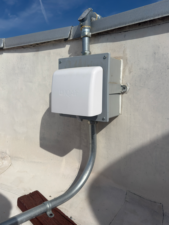
Station gallery

25th St and Marguerita Ave, Santa Monica
38
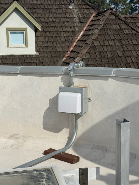
Newest stations deployed in Santa Monica
AQI⁺ station rankingNewest stations

Clean Air Facilities


Learn more about global air quality


Learn more about air pollution in Santa Monica
Does Santa Monica have bad air quality?
Santa Monica is a bustling coastal town on the edge of Los Angeles County, about 15 miles west of downtown Los Angeles and adjacent to several affluent areas with illustrious neighborhoods, universities, and tech industry hotspots.
Due to its proximity to the coast, Santa Monica typically doesn’t experience poor air quality relative to the urban areas around it, such as the city of Los Angeles. Coastal winds and offshore breezes blow low-lying pollutants, such as PM2.5, away from the city in a southerly direction down the California coast and inland, primarily eastward towards other coastal cities in western Los Angeles County and even further inland cities like Redlands, San Bernardino, and Crestline, a distant mountain community.1
Santa Monica is also well known for its plentiful options for getting around in the city.
However, like much of Los Angeles County, Santa Monica is densely populated, currently home to approximately 90,000 residents.2 Several major highways and thoroughfares pass through the Santa Monica city limits as well – the US Interstate 10 highway has its western terminus within the Santa Monica city limits, and the scenic Pacific Coast Highway 1 (often called PCH in local vernacular) takes drivers through Santa Monica between its storied Santa Monica Pier and Ocean Ave, which contains numerous luxury hotels, apartments, and shopping centers that attract over 8 million visitors a year from around the world.3
Vehicle emissions from traffic on these highways as well as vehicles circling around city streets searching for parking on busy commuter or shopping days both contribute greatly to local air pollution.
Use the Santa Monica air quality map to keep track of hyperlocal changes in pollution levels, including along Santa Monica’s famed shopping thoroughfare known as the 3rd Street Promenade.
Air quality data in the Santa Monica and nearby coastal areas is still somewhat sparse, but predictive data based on IQAir AirVisual artificial intelligence insights help fill in the gaps in data regarding air pollution levels in Santa Monica. Learn how you can get involved as a member of our crowdsourced community of air quality data contributors to enrich the breadth and accuracy of our air pollution data.
Why is air quality bad in Santa Monica today?
Vehicle traffic is the most common source of Santa Monica air pollution. In general, vehicle emissions produce most of the airborne pollutants in Santa Monica’s air at any given time, including:
- 71 percent of Pb
- 67 percent of NO2
- 57 percent of CO
- 6 percent of VOCs
- 5 percent of PM2.5
- 2 percent of PM10
Heavy daily vehicle traffic in Santa Monica means that, in general, vehicular emissions result in extremely high amounts of nitrogen dioxide (NO2) pollution in Santa Monica. A high concentration of NO2 makes ozone more likely to be generated due to a combination of heat from sunlight and chemical reactions of NO2 and other precursor pollutants with sunlight.
Ozone pollution is typically much worse during the summer. Long periods of sunlight at the coast increases the period of time during which NO2 and other pollutants from vehicle traffic, which are typically at much higher levels during the summer due to tourists visiting Santa Monica’s miles of beaches and shopping destinations, can react with sunlight. Marine inversions can cause high levels of air pollution, especially PM2.5 and ozone, to remain high even during the night.
What causes air pollution in Santa Monica?
According to a study conducted by graduate students at the Pardee RAND Graduate School at the nearby RAND Institute, the daily population of Santa Monica explodes during weekday working hours and during the busy weekend tourist rush.4
The study found that up to an additional 60,000 people commute into the city for work during Los Angeles’ infamous rush hour traffic, and another 160,000 visit Santa Monica during the weekend, with Santa Monica’s temporary visitor and resident population sometimes reaching up to 260,000 on its busiest days. This can cause daily PM2.5 levels from vehicle traffic to increase dramatically.
Nearby wildfire smoke can also impact air quality in Santa Monica. Wildfire smoke contains a variety of both particulate, gaseous, and chemical pollutants from burning brush, buildings, and other materials that can travel for hundreds of miles beyond its source. In August 2020, wildfires in the Bay Area and in Los Angeles County caused daily PM2.5 levels to spike nearly four times from a daily average of 10 µg/m3 as high as 41.8 µg/m3 in a matter of days.
Santa Monica’s marine climate can also lead to a phenomenon known as a marine inversion. An inversion happens when a layer of warm air in the upper atmosphere traps pollutants in colder air in the lower atmosphere. A marine inversion is a specific type of inversion that happens when cool, moist, dense air blows inland from the ocean and underneath the warmer, drier, less dense air higher in the atmosphere. This means that pollutants present in the lower atmosphere from vehicle traffic and other low-lying pollutants are unable to rise into the atmosphere and disperse, allowing them to build up to high concentrations in the cool, moist air at low elevations.
Does Santa Monica have smog?
Like much of Los Angeles County, Santa Monica suffers from a phenomenon known as “smog”.
Smog is a term for a specific kind of ambient air pollution that results from a combination of airborne pollutants, including ozone (O3) and particle pollution, especially PM2.5 and ultrafine particles. Smog is well known to many Santa Monica residents because of the hazy grey cloud that can limit visibility beyond city limits and be seen for miles away, even away from the coast as far away as distant Catalina Island, roughly 50 miles away from Santa Monica across the California channel.
What makes Santa Monica smog so toxic? It’s best to understand the components of smog that help contribute to its development and why these pollutants are dangerous to human health.
One of the major ingredients in smog is ozone. Ozone is a gas comprising three oxygen atom that can react chemically with your lung tissue and irritate your respiratory system, resulting in shortness of breath and coughing. Ozone is also what’s called a secondary pollutant – it doesn’t occur naturally on its own, but rather develops when other pollutants at ground level, especially NOx and volatile organic compounds (VOCs) that are emitted by vehicle exhaust, react with heat from sunlight, resulting in chemical reactions that produce O3 molecules. Over time, ozone exposure can also cause airway infections and even contribute to premature death linked to air pollution due to chronic lung damage.
The other major ingredient in smog is PM2.5. This term refers to particle pollutants that measure less than 2.5 microns across. PM2.5 is known as a combustion particle – this means that it results primarily from process that involve burning, such as industrial emissions from factories, oil refineries (many of which dot the California coastline), and vehicle traffic.
PM2.5 can also reach Santa Monica from major wildfires whose smoke travels for hundreds of miles beyond the source of the fire. In August of 2020, record-breaking wildfires in the San Francisco Bay Area blew smoke hundreds of miles down the California coast through major coastal cities like San Luis Obispo and Santa Monica, whose average daily air quality index skyrocketed from around 10 µg/m3 (right at the World Health Organization’s threshold for “safe” air quality) in the days leading up to the wildfires as high as 41.8 µg/m3 in the first weekend after the San Francisco Bay Area wildfires began.
This combination of ozone and PM2.5 is the biggest culprit behind Santa Monica air pollution. This page will provide you with the most accurate, timely air quality data for Santa Monica at any given time. The field labeled as “main pollutant” shows which pollutant is the most dangerous at its current level in comparison to other air pollutants. This pollutant is what results in the air quality index (AQI) score calculated for the city. When you see that PM2.5 is the main pollutant in the AQI score, vehicle traffic or local wildfires are likely the cause. When you see that ozone is the main pollutant in the AQI score, this likely indicates that a combination of elevated temperatures, low winds, a possible marine inversion (especially if ozone increases later in the evening or overnight), and a high concentration of vehicle or industrial pollutants are the cause.
Use Santa Monica forecast air quality data provided here to help decide how to plan ahead for air quality exposure and take the proper precautions to avoid excessive air pollution exposure during periods of heavy air pollution, such as during rush hour traffic or wildfire season.
Is air quality better in Santa Monica than LA?
Due to its proximity to the California coast, Santa Monica air quality is typically much better than the air quality farther inland towards downtown Los Angeles and the adjacent urban and suburban areas of Los Angeles County, where a combination of warm weather throughout the year and constant highway traffic often lead to dangerous levels of air pollution.
Santa Monica has also benefited from a recent shift towards the use of cleaner, fuel-efficient hybrid and electric vehicles that has been driven by the affluence of its local population, who purchase fuel-efficient vehicles at high rates for their long commutes throughout Los Angeles County, and a growing infrastructure for electric vehicle use that encourages the purchase of fuel-efficient vehicles even for those who commute to Santa Monica for work.
An recent increase in public transportation in Santa Monica has also resulted in improvements in local air quality by reducing vehicle traffic in favor of modes of transportation that produce less emissions. In 2015 and 2016, the Exposition Metro Line Construction Authority built a 6.6-mile extension on the Los Angeles Expo Line, a light rail line that traditionally carried travelers from Grand Central Station in downtown Los Angeles past Exposition Park near the University of Southern California and western Los Angeles neighborhoods, from Culver City to downtown Santa Monica.5
Hopeful estimates of the impact of the Expo Line project that the use of the Expo Line into Santa Monica will reduce vehicle traffic by small but significant numbers. Immediately after its opening, the Expo Line was used by an average of 20,000 riders each day, as compared to the 300,000 vehicles that use the nearby I-10 freeway each day, potentially reducing vehicle traffic on the I-10 each day by nearly 7 percent.6 The presence of the Expo Line has yet to result in any major reductions in local air quality from vehicle traffic, and the Expo Line is not without its major crowding and congestion problems during the busiest hours of the daily commute, but these problems may be ameliorated with increased boarding times and incentives for commuters to take the train rather than their vehicles, such as free Metro days or reduced prices during off-peak hours.7
Though this figure seems like a drop in the bucket, local public transportation can help continue to reduce vehicle traffic in the area by providing more frequent boarding times for the Expo Line, increasing the presence of low-emission, fuel-efficient bus lines, and increasing the availability of walkable and bike-able spaces throughout the city.
+ Article Resources
[1] Guerin E. (2018, October 3). Take a deep breath and read about how bad LA smog really is. LAist.
[2] United States Census Bureau. (2019). Population estimates, July 1, 2019: Santa Monica city, California.
[3] City of Santa Monica. (2020). About us.
[4] Pauker M. (2019, March 14). Local researchers study Santa Monica air quality. Santa Monica Daily Press.
[5] Los Angeles Metro. (2020). Expo Line to Santa Monica.
[6] Guiliano G, et al. (2018). Does light rail reduce traffic? The case of the LA Expo Line. Transfers Magazine.
[7] Broverman N. (2019, November 8). Will the problems that plague the Expo Line get worse next year? Los Angeles Magazine.
Where is the cleanest air quality in Santa Monica?
- Franklin Street 119
- 1804 4th St22
- ESL, Perl Street25
- Santa Monica College station26
- 14th Street27
- 25th St and Marguerita Ave38
- 431 7th St38
- 350 21st St39
- Ocean Park, Santa Monica, CA, USA39
- outlier39
- 1160-1100 10th Ct44
- 139 Ocean Park Blvd44
- SMC_FF4244
- 727-799 12th St46
- 1415 26th St47
- 2113 La Mesa Dr47
- First Pres Nursery School47
- 2433-2425 16th St48
- 24th and San Vicente50
- 930 Lincoln Blvd50
- 1673-1639 17th St51
- 700-730 Pine St51
- 1732-1704 21st Ct52
- XRDS Elementary School52
- Wilshire-Montana53
- 3rd&Cali58
- 12th & Montana Ave62


