Calgary air quality map
Live air pollution map of Calgary • 287.2K Followers • 06:00, Jul 17 Local time


Stations
Clean Air Facilities
Contributors
Government
1Diplomatic
0Non-profit
1Education
0Corporate
0Healthcare
0Hospitality
0Individual
43Top contributors in Calgary
Who is sharing outdoor air quality data in Calgary?
Featured station
Discover some of the best station installation in Calgary
Station gallery

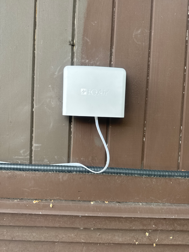
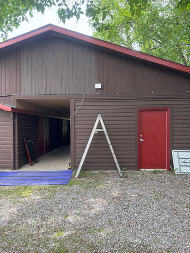
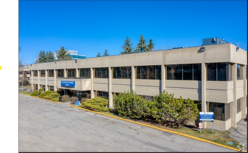
Between Friends - Camp Bonaventure (South Site), Calgary
44
Newest stations deployed in Calgary
AQI⁺ station rankingNewest stations

Clean Air Facilities


Learn more about global air quality


Learn more about air pollution in Calgary
Is Calgary a city with a good quality of air?
Calgary is a city located in the southern region of Canada, not far from the northern border of the United States, and is contained within the province of Alberta. It saw a huge amount of development due to being at the center of Canadas oil industry, and is now a well developed city with many skyscrapers and a good urban infrastructure. It has a population of approximately 1.58 million people, making it the most populous city in the province of Alberta, and second out of all cities in the western portion of Canada.
It has a strong economy centered around energy production industries, the finance sector, entertainment, technology and many more, being home to many corporate headquarters and head offices. Whilst these are all great factors for quality of life for its inhabitants, it can occasionally have an effect on the pollution levels, bringing the numbers to less than appreciable levels. Whilst overall it has a very good quality of air in regards to cities worldwide, there are certain months when the pollution levels rise.
In 2019, Calgary came in at 3828th place out of all cities ranked worldwide, with a PM2.5 reading of 6.9 μg/m³, one that placed it into the World Health Organizations (WHO's) target rating for the best quality of air at 10 μg/m³ or less, with the closer to 0 a city achieves of course being the most optimal. This very respectable reading of 6.9 μg/m³ also placed it in 71st place out of all cities ranked in Canada, showing how good the countries overall air quality is, which in itself ranks 90th out of all 98 countries registered worldwide, being one of the countries that sees some of the cleaner air qualities round the globe.
What are some of the main causes of air pollution in Calgary?
Whilst much of the year sees a great level of air quality, there are times when these PM2.5 readings rise considerably, which will be discussed in more detail in following. PM2.5 refers to particulate matter that is 2.5 micrometers or less in diameter, on occasion going down to sizes as small as 0.001 microns across. Due to this extremely small size, it has the potential to cause significant damage to human health, and as such is used as a major component in the calculation of the overall AQI, or air quality index.
Some of the main causes of pollution in Calgary would be emissions from vehicles, ranging from personal ones such as motorbikes and cars, up to industrial or service ones such as trucks, lorries and buses, with these larger ones often releasing higher amounts of fumes and thus being a significant contributor to pollution levels, as well as releasing microscopic traces of rubber on the roads in large quantities. Other causes include ones such as industrial emissions, coming from factories and power plants, as well as the agricultural sector. Construction sites can release numerous contaminating chemicals and fine particulate matter into the air, and lastly, the burning of wood by individual citizens can also skew the air quality readings, leading to higher numbers being shown.
What are some of the main pollutants found in the air in Calgary?
Due to a large amount of sectors and industries contributing to pollution levels in Calgary, there would be a wide variety of chemical contaminants and fine particulate matter permeating the ground level air and upper atmosphere in Calgary. Some of these would be ones that see their release from vehicles, which include black carbon, the main component of soot and a potent carcinogen when inhaled. It also has prominent effects on the environment due to its property of absorbing solar radiation and releasing it as heat, having climate altering effects if left to gather in large enough quantities. Other chemicals released from vehicles include nitrogen dioxide (NO2) and sulfur dioxide (SO2), with nitrogen dioxide always being the most prominent offender when it comes to pollution found over areas of high traffic.
Other noteworthy pollutants in the air would be volatile organic compounds (VOC's) such as benzene, methylene chloride and formaldehyde, of great danger to human health due to their ability to maintain a gaseous state at much colder temperatures, and thus much easier to respire. In closing, others found in the air would be microscopic particles of rubber and plastic, as well as finely ground silica and concrete dust released from construction sites, alongside dioxins, furans and even the occasional toxic metal such as lead or mercury.
When is the air quality at its best in Calgary?
Going off the data gathered over the course of 2019, Calgary saw its best levels of air quality in the months of June through to November, and whilst the whole year itself came in with respectable readings within the WHO's target goal (aside from one month that came in significantly higher, which was May with a reading of 14.4 μg/m³), there were periods where the PM2.5 levels dropped even lower, albeit without as strong a pattern as some other cities that see distinct summer and winter seasons occurring.
The cleanest months of the year were April (somewhat anomalous due to being sandwiched between two much more polluted months), June, September and November, all with PM2.5 readings of 4.9 μg/m³, 4.9 μg/m³, 4.4 μg/m³ and 4.9 μg/m³ respectively, with the number 4.9 μg/m³ making multiple appearances. This indicates that September was the cleanest month of the entire year during 2019 with its reading of 4.4 μg/m³.
Is the air quality improving in Calgary?
Looking at the data taken in the years prior to 2019, we can observe that there was a difference in the yearly averages available. 2017 came in with a PM2.5 average of 7.5 μg/m³, a respectable reading by any means that was still within the WHO's target goal. This was followed in 2018 with a yearly average of 10.9 μg/m³, one that represented a significant jump that was enough to earn itself a place in the ‘good’ ratings bracket, which requires a PM2.5 reading of anywhere between 10 to 12 μg/m³ for classification. So, in hindsight, with 2019’s reading of 6.9 μg/m³ being available, it is clear that the air quality has improved over the last two years, a great indicator that any initiatives in place to clean up the air are indeed working, and may see further improvements over the following years.
Where is the cleanest air quality in Calgary?
- 5705 23 Ave SE30
- Northwest Calgary 233
- 100 Gordon Dr SW43
- 3248 Breen Crescent NW43
- Heritage Isle44
- Tuscany Calgary, AB44
- Upper Mount Royal44
- 302 - 200 Patina Court SW46
- Northwest Calgary46
- 2144 Paliswood Rd47
- 3815 16 St SW47
- 469-555 85 St SW49
- 72 Ave NE49
- Between Friends - Camp Bonaventure (South Site)50
- Evergreen Hill SW50
- Ranchlands50
- Silverview DR Silver Springs50
- Southeast Calgary51
- 26-54 Macewan Park View NW52
- Ranchridge Court Calgary52
- Wildwood52
- Coach Hill53
- Cranston Ridge 253
- Kensington53
- McKenzie Lake53
- Stranraer53
- 1527 Lake Twintree Way SE54
- 250-196 Citadel Estates Heights NW54
- CALGARY SOUTHEAST54
- Evanscrest Pl NW54
- Vientos54
- Citadel55
- Cranston55
- Hawkwood55
- Nolan Hill55
- Walden55
- Calgary Central256
- Springbank56
- West Hillhurst56
- Calgary Central Inglewood57
- Calgary Northwest57
- Calgary Varsity57
- Auburn Bay58
- Patterson Bay SW58
- Edgemont59
- Homestead60
- Everstone, Calgary65
- Montgomery, Calgary68


