


Fresno County air quality map
Live air pollution map of Fresno County • 87.4K Followers • 17:00, Oct 19 Local time




Stations
Clean Air Facilities
Contributors

Government
3
Diplomatic
0
Non-profit
0
Education
2
Corporate
0
Healthcare
0
Hospitality
0
Individual
9Top contributors in Fresno County
Who is sharing outdoor air quality data in Fresno County?
Featured station
Discover some of the best station installation in Fresno County
Station gallery

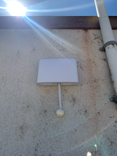
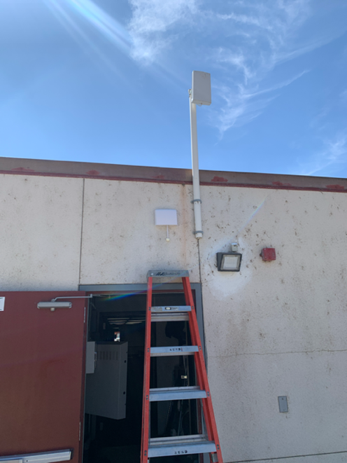
Sierra High School, Fresno County
28
Newest stations deployed in Fresno County
AQI⁺ station ranking
Newest stations




Learn more about global air quality


Learn more about air pollution in Fresno County
Why is Fresno air quality so bad today?
Located in the heart of the Central Valley in California, an enormous center of the global agricultural trade, Fresno is a city of over half a million people located about 200 miles north of Los Angeles and 180 miles south of the San Francisco Bay Area, the state’s two largest urban centers.
Fresno’s air quality is affected by numerous factors, including:
- vehicle emissions from commuters, tourists, and truck traffic
- factory emissions from industry and farming operations
- dust and PM10 from farming
- pesticides and other airborne chemicals from agricultural processes
- smoke from nearby wildfires in the nearby mountains or distant forests
Use the Fresno air quality map to monitor air quality and air pollution levels in numerous areas around the city of Fresno and Fresno County. Hyperlocal air pollution levels may vary significantly across the city, especially in areas near farming hubs or highways during peak traffic hours.
What causes air pollution in Fresno?
Fresno’s role as a major hub for the region’s agricultural industry as well as its confluence of several major state highways, including the California State Route 99 highway that cuts straight through the heart of Fresno and the nearby Interstate 5 about 50 miles to the west, both contribute greatly to its consistent ranking as one of the most polluted cities in the United States.
Particulate pollution, such as PM2.5, from vehicle emissions from commuter vehicles, logistics and transportation vehicles like semi-trucks, and farming equipment combined with consistent levels of dust and vapors from farming and pesticide use along with a geography that traps pollutants in the low elevations of the Central Valley. Ozone is also often an issue due to the high heat and high levels of particle and gas pollutants that react with sunlight to create ozone, especially during its hot California summers.
Furthermore, smoke that travels from wildfires throughout the state often reaches the Fresno area and worsens the city’s already poor air quality, often increasing air pollution levels significantly. In August of 2020, major wildfires in Northern California caused the air quality index (AQI) in Fresno to rise well into the “Unhealthy” category, with a daily average of over 150 AQI and peaking at 219 (“Very Unhealthy”) overall in the first weekend after the fires began.
Vehicle traffic in Fresno is consistent throughout the year due to Fresno’s location as an agricultural and industrial center as well as its importance as a stop for many travelers going between California’s major urban areas and to visit nearby national parks like Yosemite, Sequoia, and Kings Canyon in the Sierra Nevada mountains to the east of Fresno. Nearly 1.5 million largely fuel-inefficient trucks pass through Fresno County each year, contributing to diesel and particle pollution.1 Furthermore, the tourism industry alone generates about $1.4 billion for hotels, restaurants, and gas stations in Fresno County each year, which reflects the high number of visitors who also contribute to its poor air quality.2
Emissions from passenger vehicles, trucks, and gas-powered farming equipment result in very high concentration of nitrogen dioxide (NO2) and Nox pollution in Fresno. NO2 is a common pollutant that reacts with sunlight to form ozone, A high concentration of NO2 makes ozone more likely to be generated due to a combination of heat from sunlight and chemical reactions of NO2 and other precursor pollutants with sunlight.
Ozone, one of Fresno’s most common air pollutants, is a gas that’s made up of three oxygen atoms. When ozone molecules are inhaled, they can cause chemical reactions in lung tissue that irritates the airways and result in symptoms like coughing and difficulty breathing. Because ozone is only created when heat from sunlight reacts with pollutants like NO2 from vehicle exhaust, it’s referred to as a secondary pollutant. Because of its high prevalence in Fresno, ozone exposure can exacerbate symptoms of respiratory conditions like asthma and COPD, and even lead to infections and premature death caused by lung damage from ozone.
Ozone pollution become much worse during long, hot California summers in the Central Valley that provide longer periods of time for ozone to develop in the sunlight. Traffic through the city increases during the summer travel season as well as during tourist season in the winter, when millions travel to and stay in Fresno for access to nearby mountain resorts for skiing, snowboarding, and other outdoor recreation. Cool weather inversions during summer and winter nights can also trap high levels of PM2.5 and ozone in cool, low-lying air that is unable to rise into the atmosphere and disperse into the warmer higher atmosphere.
Is Fresno the most polluted city in the United States?
Fresno has consistently been ranked among the top 10 most polluted cities in California over a number of years. According to the 2020 State of the Air Report by the American Lung Association, the Fresno/Madera/Hanford metropolitan area ranks the following for each major type of air pollution:3
- Ozone: #4 worst of 229 metropolitan areas in the United States
- Annual Particle Pollution: #2 worst of 216 metropolitan areas in the United States
- Short-Term Particle Pollution: #1 worst of 204 metropolitan areas in the United States
Fresno County overall also received an F for all three pollutant measurements, indicating that poor air quality from ozone and particle pollution poses a distinct threat to the health of not only its most sensitive groups but also to the entire population at large.
Both ozone and particulate pollution are especially problematic for Fresno’s population of those who suffer from cardiac or respiratory conditions, such as asthma and COPD. These groups are defined as “sensitive groups” by the air quality index (AQI) standard used by the Environmental Protection Agency, the standard upon which the IQAir AirVisual AQI measurement is based.
At the most recent count, Fresno County’s total population of 994,400 included the following number within the “sensitive groups” categories:
- 17,298 children with asthma
- 60,395 adults with asthma
- 31,587 adults with chronic obstructive pulmonary disorder (COPD)
- 385 adults with lung cancer
- 45,225 adults with cardiovascular disease
Who is most at risk for air pollution exposure in Fresno?
The population of Fresno County also contains a high number of people living below the poverty line, with about 208,627 residents (about 21% of the total population) falling into the low-income category. The median household income of Fresno residents is also significantly lower than the California median, at about $48,600 per year in comparison to California’s media of $71,805 per year.
Throughout the United States, research suggests that low-income groups are much more vulnerable to the health effects of air pollution due to the proximity of many poverty-stricken communities to sources of pollution, such as factories and busy highways that are both common to the Fresno area. Fresno represents just over 1% of the over 18.7 million people in the United States who meet the criteria for the federal definition of poverty.4
Fresno also contains a significant non-white population who are at much higher risk of exposure to the region’s most dangerous and concentrated pollutants, due in large part to the presence of migrant workers who occupy a high percentage of the region’s agricultural and service jobs.
Out of the region’s total population, 705,643 (about 71%) are non-white, a group that includes Hispanic, Asian, and African American populations – the city of Fresno itself reflects this, as about 49% of the population is Hispanic, 13.8% is Asian, and 7.4% is Black (a total of 70.2% of the city population).5
Research shows that members of these groups, in particular African Americans, are more likely to be at risk of complications due to air pollution exposure, including premature death.6 Across the United States, over 14 million people of color (about 11% of the U.S. population) lives in counties like Fresno County that fail for all three air pollution tests (ozone, 24-hour particle pollution, and annual particle pollution) in comparison to 3% of whites. Fresno represents about 5% of all people of color in the United States at high risk for dangerous air pollution exposure.
How does Fresno air quality compare to Bakersfield air quality?
Bakersfield, another major agricultural and industrial hub in California’s Central Valley, also received poor marks for regional air pollution in the 2020 State of the Air report – in some cases, air quality in Bakersfield is much worse than air quality in Fresno, with the following rankings for each measured pollutant:
- Ozone: #3 worst of 229 metropolitan areas in the United States
- Annual Particle Pollution: #1 worst of 216 metropolitan areas in the United States
- Short-Term Particle Pollution: #2 worst of 204 metropolitan areas in the United States
Bakersfield ranks worse than Fresno on ozone and annual particle pollution, but just behind Fresno in 24-hour particle pollution. Its population is close in size to that of Fresno, last estimated at 896,764, and with its own significant numbers of sensitive groups close in proportion to that of Fresno:
- 16,001 children with asthma
- 53,894 adults with asthma
- 27,502 adults with chronic obstructive pulmonary disorder (COPD)
- 348 adults with lung cancer
- 39,003 adults with cardiovascular disease
Much of Bakersfield also lives in poverty. Nearly 1/5 of Bakersfield’s residents (177,021, or about 19.8%) fall below the poverty line, slightly below Fresno’s estimate. People of color make up about 66.5% of Bakersfield’s population, slightly less than in Fresno, but still well over half of the city’s population.
Despite its high ranking for the worst air pollution in the United States for multiple pollution measurements, Fresno air quality and Bakersfield air quality has actually improved over the last two decades. Since 1996, Fresno has experienced 131.4 fewer days of ozone pollution overall, from a peak of 217.2 days during the 2001-2003 period to 85.8 days during the 2016-2018 period.
Fresno has also experienced 33.4 fewer days per year of 24-hour particle pollution since 2000, from a peak of 71.2 days during the 2000-2002 period down to a 37.8 days during the 2016-2018 period (and a record low of 27 days during the 2015-2017 period). Fresno has also reduced its annual concentration of particle pollution by 5.1 µg/m3.
+ Article Resources
[1] Traffic Census Program: 2016 traffic volumes on California State Highways. (2020). Caltrans.
[2] Sheehan T. (2016, May 1). Tourists spent $1.4 billion in Fresno County in 2015. The Fresno Bee.
[3] American Lung Association. (2020). Most polluted cities.
[4] The United States Census Bureau. (2019). How the Census Bureau measures poverty.
[5] Fresno, California. (2020). City Data.
[6] American Lung Association. (2020). Disparities in the impact of air pollution.
Where is the cleanest air quality in Fresno County?
- Soaproot Saddle station4
- South Lac Jac Avenue7
- Chahlip Lane27
- Sierra High School28
- West Ashlan Avenue28
- Shepherd Lane29
- Mercey Hot Springs32
- Tranquility - 32650 West Adams Avenue 35
- Tranquillity36
- 15235 Morgan Canyon Rd37
- Whispering Springs Lane42
- Foothill Air Quality44
- Fresno-Sierra Skypark46
- Fresno - Sierra Skypark #247
- Pinehurst47
- Dos Palos (San Joaquin River)57
- Fresno - Drummond Street66


