Los Angeles air quality map
Live air pollution map of Los Angeles • 16.2M Followers • 19:00, Oct 19 Local time






Stations
Clean Air Facilities
Contributors

Government
3
Diplomatic
0
Non-profit
3
Education
162
Corporate
0
Healthcare
0
Hospitality
0
Individual
225Top contributors in Los Angeles
Who is sharing outdoor air quality data in Los Angeles?
Featured station
Discover some of the best station installation in Los Angeles
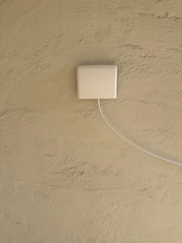
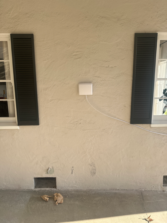
Station gallery

Johnny 5, Los Angeles
39
Newest stations deployed in Los Angeles
AQI⁺ station ranking
Newest stations

Clean Air Facilities



Learn more about global air quality


Learn more about air pollution in Los Angeles
What is the air quality in Los Angeles?
Los Angeles air quality averages a US AQI or air quality index rating of “moderate.” Monthly averages in 2019 varied from AQI 32 (“good”) in February to AQI 64 (“moderate”) in November. Despite seemingly optimistic ratings, Los Angeles’s air pollution is among the worst in the United States, both for PM2.5 and ozone.
PM2.5 is airborne particulate matter measuring up to 2.5 microns in size. It is widely regarded as one of the most harmful pollutants to human health for its prevalence at dangerous levels. Exposure to PM2.5 has been linked to health effects such as heart disease, respiratory illness, and premature death.
For PM2.5, the greater Los Angeles county contains 9 of the 15 most polluted cities in the United States, according to the 2019 World Air Quality Report. In this same report, the city of Los Angeles ranked 82nd in the US (out of 1,517 included cities). Its annual average, however, differed by only 4 micrograms from the number one most polluted city in the U.S.: Portola, California.
According to the 2019 State of the Air report, which compared data across 229 metropolitan areas, Los Angeles has the worst ozone air pollution in the United States. Ozone is a gas pollutant formed when sunlight reacts with nitrogen oxides and organic substances. Vehicle exhaust contains both the nitrogen oxides and reactive organic substances needed to form ozone, so traffic is frequently identified as a leading source. Like PM2.5, ozone can cause health effects ranging from respiratory infections and inflammation to premature death.
Together, PM2.5 and ozone form the smog that Los Angeles is often known for. The summer months of June, July, and August tend to be more polluted than other months for both PM2.5 and ozone. This is because of drier conditions, less rainfall, higher temperatures, and a higher frequency of wind-blown dust and wildfires fanned by the Santa Ana winds.
Los Angeles does not currently meet the U.S. EPA’s national air quality standards for both PM2.5 and ozone.1 The associated health implications are evident in the numbers. According to the County of Los Angeles Public Health Department, 1 in 10 children have been diagnosed with asthma.2 Overall risk for cancer, meanwhile, is increased by 900 for every million, according to the South Coast Air Quality Management District.
Air pollution data is an important resource for taking action to mitigate these health effects. Refer to the top of this page for Los Angeles’s forecast air quality data and real-time air quality data.
Has air quality improved in Los Angeles?
Los Angeles air quality has dramatically improved over the last 30 years because of the 1990 amendments to the Clean Air Act. Most recently, year-over-year trends have resulted in reductions in L.A. air pollution of 10.6% from 2017 to 2018, and another 11.8% from 2018 to 2019.
Data collected by EPA governmental monitors and analyzed in the COVID-19 Air Quality Report found that Los Angeles experienced a long stretch of WHO-target air quality (< 10 μg/m3) from March 7-28, 2020, its longest streak since at least 1995. This 18-day stretch of exceptionally clean air is likely the result of lockdown measures put in place to reduce the spread of the COVID-19 pandemic, during which non-essential businesses were ordered to close and residents were urged to stay at home. March 2020 became Los Angeles’s cleanest air quality month on record, averaging PM2.5 levels of 5.6 μg/m3 (US AQI 23).
Yearly averages are often dependent on the wildfire season, which can contribute to greatly elevated periods of city-wide air quality. The last three years have seen fewer state-wide forest fires and burned acreage, though wildfires are expected to increase in frequency over the long term as temperatures rise droughts become longer.
Why does Los Angeles have unhealthy air quality?
Los Angeles is a city notorious for its smog, a combination of particle and ozone pollution. The prevalence of these pollutants result from many factors, including the burning of fossil fuels, especially by vehicles, ships, planes and manufacturing, as well as wildfires.
The large population of 4 million in Los Angeles, with another 6 million in the surrounding Los Angeles county, contributes significantly to the its ‘nonattainment’ air quality status because of heavy vehicular emissions and traffic congestion. It is estimated that there are 6.5 million vehicles in the city of Los Angeles alone. Current mayor Eric Garcetti set forth a sustainability plan that seeks to increase zero-emission vehicles in the city, growing their share from 1.4% in 2018 to 25% by 2025, and 100% by 2050.3 Power consumption, BBQs, and other such personal local emissions are also a major source of air pollution as a result of the city’s population.
Los Angeles’s shipping industry is another key contributor, particularly in recent years as trade with Asia has expanded. The Port of Los Angeles and the Port of Long Beach are the two busiest container ports in the United States. 4 Many port operations rely on fossil fuel or diesel to power ships, trucks, and other transportation. Since the implementation of the Clean Air Action Plan of 2006, particulate matter (PM) from these operations has dropped by 87%, while nitrogen oxides, an important precursor pollutant to ozone, are down 58%. Still, the ports remain a significant pollution source, producing an estimated 100 tons of smog daily, with little year-over-year improvement since 2011. The Los Angeles air pollution map often reveals higher AQI in Los Angeles’s port areas. Port authorities are looking for new ways to further decrease these emissions, such as investing cleaner energy transport vehicles.
Although they’re temporary and sporadic, wildfires often impact yearly average air pollution in Los Angeles. A combination of dry conditions, highly flammable fuels (such as the volatile Douglas fir and ponderosa pine tree species), increasingly hot summers, steep mountains, and strong Santa Ana winds combine to make the area highly susceptible to large and severe wildfires.
The geography of Los Angeles, in a basin surrounded by mountains, is further conducive to trapping air pollution. While many locations around the world commonly experience temperature inversions in the winter, Los Angeles often experiences a similar effect in warmer months. This happens when relatively warm air from the Great Basin or inland Los Angeles traps cooler, ocean air close to the Earth’s surface, preventing polluted air from rising and dispersing. This type of temperature inversion is called a marine inversion. The Los Angeles marine inversion can often be attributed to the layer of haze shrouding downtown buildings in pictures from the famous Hollywood sign.
How to reduce air pollution in Los Angeles?
While air pollution levels in Los Angeles still far exceed federal standards, significant improvements have been made in the last two decades. California began addressing air pollution in 1967 when it established the California Air Resources Board (CARB), an organization whose mission is to unite local governments, businesses, and residents with the goal of researching and legislating effective air pollution policy.5 This board was later empowered by the legislative action of the federal government in 1970, that established the Clean Air Act. The Clean Air Act, along with the later 1977 and 1990 amendments, created federal air quality monitoring, emission control, and enforcement. The Clean Air Act has been deemed the most effective federal regulations for clean air, estimated to have prevented as many as 237,000 deaths from 1970 to 2020.6
Current efforts have been led primarily by local and state regulations, furthering an agenda to reduce emissions across the transportation sector along with a number of high-polluting industries.
Among the most promising efforts is the shift towards electric vehicles (EVs). Currently, motor vehicles represent the leading source of city-wide PM2.5 and nitrogen dioxide, an ozone precursor pollutant. Other improvements, such as increasing the percentage of the power grid that relies on renewable energy, will be a critical step.
Long-standing trends of improving air quality in Los Angeles, coupled with promising new legislation and shifts in purchasing behavior, provide optimism for the future of air quality in Los Angeles.
Why is the air quality bad today in Los Angeles?
Changes in weather can impact local air quality. It is weather that often helps to explain a city’s air quality variations day to day when emissions remain relatively constant. Sunlight, wind speed and direction, temperature, and pressure conditions all shape current conditions. Examples of this include:
- Sunlight and heat can cause some gas pollutants (nitrogen dioxide and volatile organic compounds) to chemically react and form ground-level ozone, a secondary pollutant. Higher temperatures accelerate this reaction, increasing ozone levels.7
- Pressure cells and temperature inversions (a reversal of normal temperature conditions, in which hot air blankets cooler surface air, acting like a lid) can prevent emissions from dispersing naturally, causing a buildup of ground-level pollution.
- Rain can tamp down emissions, improving air quality.
- Wind direction and speed are perhaps the most impactful weather condition on city emissions. Stagnant air can cause emissions to become trapped in the L.A. Basin, while strong winds can move emissions out of the narrow outlets of the San Gabriel Mountains.
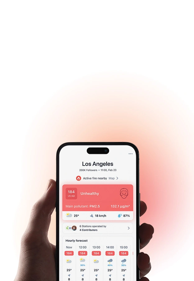
In addition to weather, extreme pollution events such as wildfires can cause significant spikes in L.A. air quality. Such pollution events have become increasingly common in the area over the last few decades as a result of anthropogenic climate change. When smoke fills the L.A. Basin, the region's geography and weather conditions can make it difficult for the air pollution to disperse, resulting in slowly accumulating pollution levels until the emissions stop or weather changes. Use the IQAir website and app to follow changing AQI levels in Los Angeles. When air is forecast to be unhealthy, reduce your exposure by limiting strenuous outdoor activity, closing your doors and windows, and running an air purifier and wearing an air pollution mask if available.
+ Article Resources
[1] California non-attainment/maintenance status for each county by year for all criteria pollutants. (2020).
[2] Mazza S. (2018, August 7). Investigation finds LA Harbor-area smog challenges grow as new health threats emerge.
[3] Roth S. (2019, May 6). Los Angeles sets dramatic new goals for electric cars.
[4] Vock DC. (2019, June). Can America’s biggest ports go green?
[5] California Air Resources Board. (2020). History. CARB.
[6] United States Environmental Protection Agency (EPA). (2020). Benefits and costs of the Clean Air Act 1990-2020, the second prospective study.
[7] National Oceanic and Atmospheric Administration. (2020). Clearing the air on weather and air quality.
Where is the cleanest air quality in Los Angeles?
- York0
- Gramercy Swamp1
- LA State Historic Park1
- MobNukem PR1
- Playa Vista1
- Selma1
- Wilmington 21
- Elysian Heights (Preston Ave)2
- LA3
- Kent's yard8
- Rincon Avenue11
- Royal Oak Rd11
- Santa Monica Canyon station11
- Grand View Boulevard12
- North Hollywood12
- Cielo Way13
- Mar Vista13
- Vulcan Drive13
- Truxton15
- Villa Marina Townhomes15
- West 74th Street15
- Lincoln and Ave 5116
- Wilshire Blvd16
- 511 North Kenter Avenue17
- Balboa Highlands17
- Gault St17
- Hatteras Street17
- Hemmingway Street17
- La Fayette PP / Marathon17
- Point Fermin17
- Tupper Street17
- Weingart East LA YMCA17
- Bryn Mawr Drive18
- Comstock-Dunkirk19
- 4074 Michael Ave20
- 4790 - Lassen Es20
- 5561 W 3rd St20
- CCA Hillcrest and Obama20
- Tacuba Street20
- Van Nuys HS/Rogers CHS (8895)20
- 11907 Pacific Ave21
- 3881 Mandeville Canyon Rd21
- 5261 Thornburn St21
- Encino, Luverne Pl21
- Linnie Canal Venice21
- Mulholland MS (8259)21
- 1352 Pso De La Lora22
- 2449 Arbutus Way22
- 8500 Louise Avenue22
- Ashwood Avenue22
- Bancroft Avenue22
- Brainard ES (2486)22
- Castlebay Ln ES (2881)22
- Colfax Meadows22
- Encino - Hayvenhurst22
- Escalon Dr22
- Estepa Dr / Crystal View22
- Fleetwood22
- Hazen Drive22
- Jolette Ave x Westbury Dr22
- Laurel ES (4808)22
- Mahoney22
- Mandeville Canyon22
- NASA - Terrace 4922
- Nestle ES (5452)22
- Serrania ES (6606)22
- Taft HS (8880)22
- Westchester-Kentwood South22
- Woodland Hills22
- 4199-4101 Madelia Ave23
- 7562 - Vintage Math/Sci Mag23
- 7637 - Welby El23
- Ackerman Drive23
- Baltimore Street23
- CSUN Live Oak23
- Canterbury Ave ES (2781)23
- Chandler ES (2959)23
- Crestwood Hills Preschool23
- Dowlen Drive23
- Glassell Park23
- Kester ES (4726)23
- Sharp ES (6665)23
- Upland Avenue23
- Valerio ES (7384)23
- Van Gogh ES (7422)23
- 11500 Canton Dr24
- 459 S Sherbourne Dr24
- 4704 St Clair Ave24
- 6192 - Ranchito El24
- 684 Kingman Ave24
- 8206 Skyline Dr24
- Andasol ES (2117)24
- CHIME Institute's Schwarzenegger Community School24
- Calabash ES (2704)24
- Central Belden Drive24
- Chatsworth Lake Manor24
- Fair Avenue24
- Hacienda24
- Hamlin ES (4349)24
- Hill Drive24
- Kester Avenue24
- Kittridge ES (4760)24
- Knollwood ES (4762)24
- Lockhurst Drive24
- Meadow Valley Terrace24
- Pagoda Place24
- Palms24
- Parthenia ES (6027)24
- Sky Valley Road24
- Village Green24
- Vinedale ES (7548)24
- Westland School24
- Wilbur ES (7774)24
- 10733 Charnock Rd25
- 3198-3148 Country Club Dr25
- 3858-3700 Vinton Ave25
- 4764 - Lanai Road Elementary25
- 4865 Patrae St25
- Anatola ES (2110)25
- Brentwood School East Campus25
- Columbus MS (8102)25
- Gridley ES (4295)25
- Halsted Street25
- Haynes ES (4473)25
- Osage Avenue25
- Victory ES (7521)25
- 1201-1291 3rd Ave26
- 22023 Bryant St26
- 254 Bronwood Ave26
- 2917-2931 James M Wood Blvd26
- 3959 - 42Nd St El26
- 4238-4294 Division St26
- 5342 - Monlux El26
- 740 Amalfi Dr26
- Aleman Drive26
- Alta California ES (7398)26
- Arroyo Seco Magnet SPAN (4322)26
- Echo Park26
- Herrick Ave26
- Marlton ES (1949)26
- Mellon Avenue26
- Mid-City Magnet ES (3500)26
- Monroe HS (8768)26
- Mosk ES (7402)26
- Newcastle ES (5479)26
- Okean Place26
- Sun Valley26
- Wonderland ES (7849)26
- name: 'Carpenter ES (2822)26
- 1199 Tower Grove Dr27
- 12910 Panama St27
- 1554 Chastain Pkwy E27
- 15613-15663 Castlewoods Dr27
- 17489 Tuscan Dr27
- 1880 Mango Way27
- 2089-2055 Old Ranch Rd27
- 2282 Mandeville Canyon Rd27
- 22nd and Meyler27
- 250 S Bristol Ave27
- 2853-2841 N Beverly Glen Blvd27
- 3834 Griffith View Dr27
- 4027 Hayvenhurst Dr27
- 4521 - Hesby Oaks27
- 6288 - Rio Vista Elementary27
- 699-645 N Gramercy Pl27
- 7781 - Wilmington Pk El27
- 7th St ES (6616)27
- 8360 Chase Ave27
- 846 Micheltorena St27
- 999-901 El Medio Ave27
- Annandale ES (2151)27
- Bel Air Hills27
- Byrd MS (8080)27
- CCA Bates and Sunset27
- Chatsworth HS (8583)27
- Compton ES (3205)27
- Eagle Rock ES (3507)27
- Encino ES (3616)27
- Green Oak Drive27
- Green Verdugo Drive27
- Oxnard ES (5918)27
- Porter Ranch27
- Reseda ES (6233)27
- Rinaldi Adult Center (9365)27
- Riverside Drive27
- San Pascual ES (6493)27
- Silver Lake27
- Sunland Boulevard27
- Vanalden ES (7411)27
- Verdugo Hills HS (8914)27
- Woodland Hills ES (7890)27
- 10663 Bellagio Rd28
- 10998-10900 Verano Rd28
- 11101-11117 Ventura Blvd28
- 1661 Alta Mura Rd28
- 2603 - Buchanan El28
- 2648-2600 Waverly Dr28
- 3417-3435 Farmdale Ave28
- 601-629 Camulos St28
- AirVisual Outdoor - MVR428
- Belfast Dr AQ28
- Brentwood School West Campus28
- Brentwood Tigertail28
- CCA 27th & Brighton28
- Colina Glen28
- Danube ES (3335)28
- Dyer ES (3493)28
- El Sereno Middle School28
- Farlin Street28
- Fletcher Square28
- Huntington28
- Justice St ES (4692)28
- Kevin28
- Mountain View ES (5404)28
- Napa ES (5446)28
- Nichols Canyon Road28
- North Valley OC (9329)28
- Pacoima Charter School28
- Silverlake28
- Trinity ES (7219)28
- Valley Glen28
- Vedanta Courtyard28
- West Silver Lake Drive28
- Yucca Street28
- 10380 Glenbarr Avenue29
- 1322 Pavia Pl29
- 135th St ES (5877)29
- 17220 Palisades Cir.29
- 2303 - Porter Ranch Community School29
- 2369-2399 Wellesley Ave29
- 28 Driftwood St29
- 2841 Lawndale Dr29
- 410-582 Amalfi Dr29
- 4820-4800 Venice Blvd29
- 5114-5198 Ithaca Ave29
- 5857 - 107Th St El29
- 5900-5998 Great Oak Cir29
- 8664 - Gardena Sh29
- Berendo MS (8057)29
- Calle de Madrid29
- Calvert ES (2712)29
- Camden Avenue29
- Cohasset ES (3137)29
- Garey Building East Courtyard Balcony29
- Jefferson HS (8714)29
- Lowman Sp Ed Ctr (1948)29
- Loyola Village29
- Mayall ES (5198)29
- Micheltorena ES (5288)29
- Multnomah St ES (5425)29
- Nevada ES (5459)29
- Sherman Oaks ES (6699)29
- Sunny Brae ES (6986)29
- Westport Hts ES (7712)29
- 551 Toyopa Dr30
- 756 S Grand View St30
- 859 Warner Ave30
- Hancock Park ES (4397)30
- Los Feliz ES (4986)30
- Normandie ES (5630)30
- Topeka Dr ES (7201)30
- 201 S Moreno Dr31
- 3810 N Riley Ln31
- 4099-3901 Sequoia St31
- 646 Frontenac Ave31
- 6649-6701 W 88th St31
- AGVX0MF331
- Chatsworth ES (3027)31
- Coeur D Alene ES (6342)31
- Fernangeles ES (3753)31
- Frank Del Olmo ES (2386)31
- Glenwood ES (4192)31
- Maclay MS (8228)31
- Palisades Country Estates31
- Palisades Dr31
- Roscomare ES (6363)31
- Sierra Park ES (6753)31
- Sierra Vista ES (6767)31
- West Hollywood31
- 10325 Walavista Rd32
- 12351 Pearl St32
- 2068 - Allesandro Elementary32
- 4098-4000 Woking Way32
- 6685 - Sheridan St El32
- A6DR4SLX32
- CCA Borden and Carl32
- Glenfeliz Blvd ES (4164)32
- Grand View ES (4247)32
- Knox ES, Dr Owen Lloyd (6869)32
- Los Angeles Ecovillage32
- Overland Avenue32
- Stonehurst ES (6945)32
- Sylmar32
- Taper ES (7035)32
- Wilton Pl El (7808)32
- 1237 N Commonwealth Ave33
- 59th St ES (3795)33
- 7370 - Utah El33
- AirVisual Outdoor - K7EW33
- Arminta St ES (2205)33
- Cabrillo ES (2685)33
- Dexter33
- El Sereno ES (3562)33
- Harding ES (4431)33
- Marquez ES (5164) #233
- N Serrano Ave33
- PicWood_Malcolm_Ave_0133
- President ES (6148)33
- Solano ES (6836)33
- The Avenue Hollywood33
- Valley View ES (7397)33
- Variel33
- W. Avenue 3533
- Weigand ES (7634)33
- 14705 Oracle Pl34
- 8544 - Roybal Lc34
- Atwater ES (2233)34
- Budlong ES (2616)34
- Canfield ES (2740)34
- Colfax ES (3164)34
- Hollywood HS (8693)34
- Lenicia Weemes ES (7151)34
- Marco Triangle Park, Venice, California34
- Stagg ES (6890)34
- Stone Canyon Avenue34
- 10925 Odell Ave35
- 2383 - Esperanza El35
- 2741 - Community Magnet35
- 4315 - Gulf El35
- Aragon ES (2178)35
- Hancock Park35
- Riverwood ranch35
- San Pedro ES (6507)35
- 7699 - Westminster El36
- Palisades HS #236
- South Shores Magnet ES (6870)36
- University of California Outside36
- Venice Beach36
- Warner ES (7616)36
- Webster MS (8481)36
- Wilshire Crest ES (7795)36
- 16735 Charmel Ln37
- Crescent Hts Bl EEC (9597)37
- Hamilton HS (8686)37
- Logan ES (4904)37
- Marvin ES (5178)37
- Playa Del Rey ES (6110)37
- Van Ness ES (7425)37
- Virginia ES (7575)37
- Emerson MS station38
- Museum Terrace Apartments38
- West Los Angeles station38
- Westwood Charter ES38
- Harvard-Westlake Middle School39
- Harvard-Westlake Upper School 239
- Huntington Palisades39
- Johnny 539
- La Salle ES (4786)39
- North Holywood39
- Richland Ave ES39
- Rosemont ES (6370)39
- Travis St.39
- Valley Circle Estates39
- W Ave 35 Alley39
- Westwood ES (7740)39
- Willoughby39
- Toluca Lake ES (7192)40
- Brentwood Sci Mag ES (2507)41
- Rim Canyon Road41
- 6137 - Point Fermin Elementary42
- Brockton ES (2548)42
- Central Los Angeles42
- Kenter Canyon Elementary School42
- N Main St42
- Pacific Palisades ES (5959)42
- Revere MS (8356)42
- Walgrove ES (7603)42
- AirVisual Outdoor - S4GL44
- Canyon ES (2795)44
- Mandeville Canyon Residence44
- Mid-Wilshire44
- palisades San remo44
- Metropolitan HS (8757)47
- AirVisual Outdoor - Stanley50
- Crestwood Hills-Tigertail Rd50
- Pacific View50
- Rustic Lane50
- playa vista house50
- Mercado La Paloma (Outdoor)52
- Lower Amalfi - Riviera53
- cheviot hills south of manning55
- Brentwood Glen56
- El Medio Bluff Outdoor56
- Delgany Ave in Playa62
- Meier St62
- N St Andrews Pl68
- Corsica73