


Pasadena air quality map
Live air pollution map of Pasadena • 109.7K Followers • 00:00, Oct 18 Local time




Stations
Clean Air Facilities
Contributors

Government
2
Diplomatic
0
Non-profit
0
Education
0
Corporate
0
Healthcare
0
Hospitality
0
Individual
42Top contributors in Pasadena
Who is sharing outdoor air quality data in Pasadena?
Featured station
Discover some of the best station installation in Pasadena
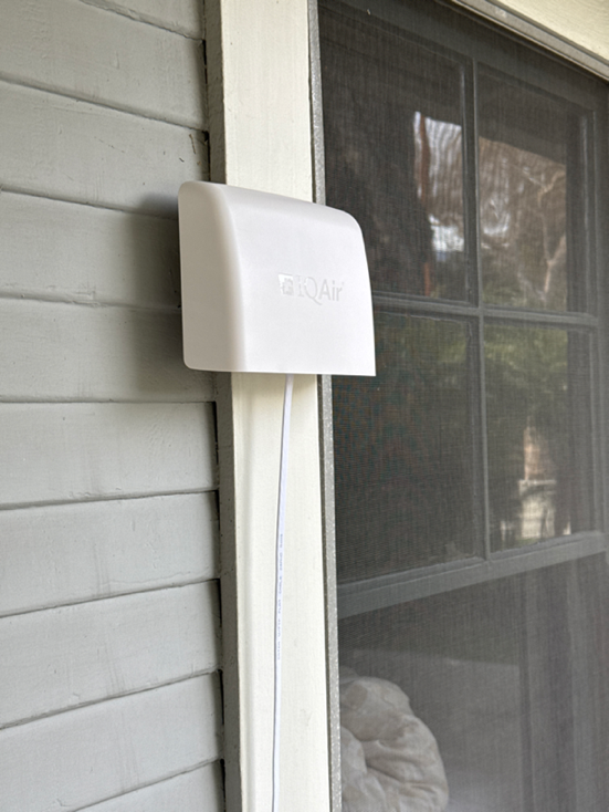
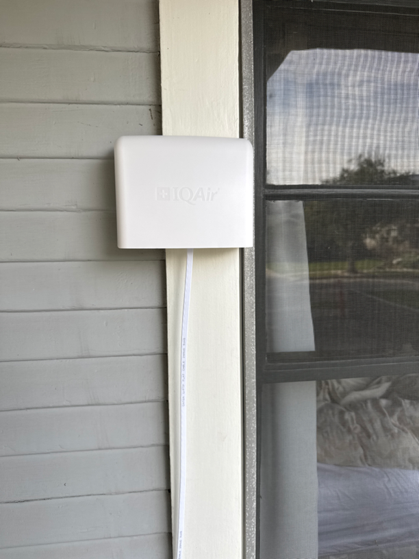
Station gallery

N Catalina Ave, Pasadena
11
Newest stations deployed in Pasadena
AQI⁺ station ranking
Newest stations

Clean Air Facilities






Learn more about global air quality


Learn more about air pollution in Pasadena
How is the air quality in Pasadena?
Pasadena is an affluent Southern California city located about 10 miles northeast of downtown Los Angeles at the foot of the San Gabriel Mountains. With a population of just over 138,000, Pasadena is known for its historic Old Town area along Colorado Blvd, the Rose Bowl stadium, the famed California Institute of Technology (Caltech), and the nearby NASA Jet Propulsion Laboratory (JPL) facility.
As measured by the air quality index (AQI), an air quality assessment standard used by the Environmental Protection Agency upon which the IQAir AirVisual AQI measurement is based, Pasadena regularly experiences air quality considered “Moderate”. Represented by a yellow color, air pollution in Pasadena at the Moderate level only poses a minor risk to the general population and a slightly elevated risk to those considered “sensitive groups”, such as children, the elderly, and those with cardiac or respiratory conditions that can be worsened by even low amounts of air pollution.1
AQI measurements in Pasadena are based largely on PM2.5 and ozone pollution, the most prevalent and deadly air pollutants in the United States. Pasadena air quality generally ranks poorly for both.
Pasadena experiences an average of 13.8 unhealthy PM2.5 days a year in addition to 111 unhealthy ozone days. Between 2016 and 2018, there were 31 “orange” PM2.5 days deemed unhealthy for sensitive groups and 7 “red” days deemed unhealthy for the general public. Many of these PM2.5 spikes in Pasadena were directly linked to pollution events like wildfires, which are becoming increasingly frequent and intense as a result of climate change.
The American Lung Association (ALA) "State of the Air" report found the greater Los Angeles County and Long Beach County region to have the single worst ozone pollution nationally out of 228 included areas. A weighted average from 2016 to 2018 revealed that there are 111 unhealthy ozone days a year, or nearly 30 percent of days. For reference, the US EPA targets no more than 3.2 unhealthy ozone days a year.
The annual ALA air quality "report card" also ranks PM2.5, or fine particle pollution. This is done through both average annual levels and short-term (24-hour) spikes. By both measures, Pasadena air quality fails to meet federal targets and moreover ranks in the top ten for the most unhealthy levels nationally.
In addition to the number of PM2.5 pollution spikes causing unhealthy pollution days, Pasadena’s annual PM2.5 level is also concerningly high, indicating an overall trend of elevated airborne particulates. In 2019, Pasadena averaged a PM2.5 concentration of 13.5 μg/m3, thus exceeding the US Environmental Protection Agency (EPA) target of 12 μg/m3, and the more stringent World Health Organization (WHO) target of 10 μg/m3.
Pasadena’s geography also contributes to the buildup of airborne pollutants in the area. Between high daily temperatures and the city’s location in the LA basin, an enormous area of flat land surrounded by numerous mountain ranges, pollutants are often difficult to disperse and can reach dangerous levels of toxicity during long periods of high heat, low winds, and lack of rain or humidity.2
Use the Pasadena air quality map to look at current air pollution levels around Pasadena and nearby neighborhoods. Hyperlocal air pollution can change drastically from place to place, especially in neighborhoods close to highways that may experience much worse air quality during periods of high traffic volume or regional pollutant build-up.
Is Pasadena air quality affected by fires?
Air quality in Pasadena has occasionally experienced enormous elevations into much higher risk categories of air quality due to regional wildfires, whose smoke can travel for hundreds of miles beyond burn areas typically located in nearby hills and mountain ranges often covered in dry brush that burns easily during California’s hot summers.
Furthermore, wildfire smoke from throughout the state, especially the Southern California region, often impacts Pasadena air quality and exacerbates high air pollution levels from daily traffic and trapped pollutants from the city’s geography.
In August of 2020, major wildfires in Northern California and in the Los Angeles area near Santa Clarita, Castaic, and Azusa caused the air quality index (AQI) in Pasadena to remain consistently above levels considered “safe” by the standards of the World Health Organization.3 At its peak, PM2.5 concentrations in Pasadena reached a daily average of 31.3 µg/m3, over three times the WHO threshold of 10 µg/m3, in the weekend following the outbreak of these fires.
Why is Pasadena pollution so bad?
Pasadena air quality suffers as a result of local and regional emissions as well as its weather and topography, which can create a trapping effect, elevating measured air quality levels. Despite its affluence and smaller size, Pasadena is not completely immune from the poor air quality that affects much of the Los Angeles region for miles outside of the Los Angeles urban core because of its close proximity and role as a commuter city in the Los Angeles area.
According to Walk Score, Pasadena’s vibrant Old Town neighborhood is considered one of the most walkable and bikeable neighborhoods in the United States.4 Much of Pasadena is also served by the fully electric LA Metro L Line light rail (formerly known as the Gold Line), allowing hundreds of thousands of commuters to get from Pasadena to major Los Angeles hubs without ever stepping on a gas pedal.5
But Pasadena is nonetheless subject to massive amounts of vehicle exhaust due to the daily rush hour as well as during the area’s booming nightlife. The nearby Rose Bowl, an outdoor stadium with a capacity of nearly 91,000 less than a mile away from Old Town, also hosts enormous concerts and events that put a strain on local infrastructure with tourist traffic.6
Sea breeze often flows inland from the coast carrying gas pollutants like ozone and particulates like PM2.5 to Pasadena. Air pollution in Pasadena is therefore the result of emissions both locally and further abroad, with common sources including the burning of fossil fuels, especially by vehicles, ships, planes, and manufacturing as well as wildfires.
Ozone is one of Pasadena’s most pervasive pollutants. Ozone (O3), a gaseous molecule comprising three oxygen atoms, can react chemically with lung tissue and irritate the airways, resulting in coughing and shortness of breath as ozone molecules displace oxygen molecules in the lungs and bloodstream. Ozone is an especially troubling air pollutant because it’s not naturally occurring and thus more difficult to manage – rather, as a secondary pollutant, ozone is generated when sunlight or other heat sources chemically react with low-lying pollutants like NO2 from vehicle emissions. The high prevalence of ozone in Pasadena can also worsen respiratory conditions like asthma because of the damage that ozone can do to the lungs over time, increasing the risk of respiratory infections and premature death from these conditions.
Pasadena, like most of the dry regions at the foot of the San Gabriel Mountains, also experiences annual rainfall well below the national U.S. average, receiving only about 21 inches of rain in comparison to the U.S. average of 38 inches a year (although slightly more than Los Angeles, which only receives about 14.7 inches of rain per year).7 Because rain not only helps lower local wildfire risk but also disperses airborne pollutants by rinsing them from the atmosphere, the lack of rain in Pasadena allows high concentrations of both particle and gaseous pollutants to build up over time. This leads to especially long periods of high air pollution levels due to both ozone and PM2.5 build-up from heat, traffic, and local events that generate abnormal increases in airborne pollution.
Is air quality in Pasadena improving?
On average, Pasadena air quality typically falls into the “Good” to “Moderate” range, with AQI scores ranging from 20-40 and PM2.5 measurements ranging from as low as 5 µg/m3 up to 20 µg/m3 or more depending on weather, traffic, and the presence of statewide wildfires.
Los Angeles County has seen very little improvement in ozone levels since 1996, with a relatively flat-appearing trend line. In the monitoring period between 1996 to 1998, LA experienced an average of 138.3 unhealthy ozone days a year. In 2016 to 2018, that number fell to 111 unhealthy ozone days a year. Over 20 years, the number of ozone days fell by just 20 percent, and still far exceeded federal targets set at 3.2 unhealthy days.
Improvements have, however, been made in Pasadena’s PM2.5 levels. Particle pollution has fallen roughly 44.7 percent, from 24.4 μg/m3 in 2001 to 13.5 μg/m3 in 2019.
Though the city is close to the dense, heavily trafficked Los Angeles area, air pollution sources like housing and vehicle traffic are not nearly as dense within Pasadena as they are in Los Angeles. Much of Pasadena’s population lives in low-density single-family homes in neighborhoods increasingly farther away from the major highways and Old Town areas that tend to be more dense and busy.8
Pasadena also benefits from its close proximity to major wilderness areas just north and east of the city that shield the city from further build-ups of air pollutants from those directions. While many cities in Los Angeles County are surrounded on all sides by freeways and other dense neighborhoods, the federally protected Angeles National Forest in the adjacent San Gabriel Mountains act as a natural defense mechanism against air pollution patterns that may otherwise blow in pollutants from neighboring cities to the north. The high elevations of many local attractions in this national forest, including mountainous trails and attractions like the Mt. Wilson Observatory, can provide a temporary respite from air pollution concentrated at lower elevations in the city.9
How does Pasadena air quality compare to Los Angeles air quality?
Like its close neighbor Los Angeles, Pasadena often suffers from daily spikes of PM2.5, a type of particulate pollutant smaller than 2.5 microns emitted in high concentrations by vehicle and industrial emissions, and ozone, formed when heat from sunlight reacts with chemicals like nitrogen oxides (NOx) also common to vehicle traffic exhaust. This is largely due to the hundreds of thousands of vehicles that pass through the city limits on the Interstates 210 and 710 freeways that meet just west of Pasadena’s Old Town during Los Angeles rush hour traffic in the mornings and evenings (about 7-10 a.m. and 4-7 p.m.).
Pasadena escapes much of the poor air quality that afflicts the neighboring Los Angeles-Long Beach metro area. The 2020 State of the Air report by the American Lung Association rated Los Angeles-Long Beach much worse than Pasadena for every pollutant measured in the report, including:10
• Ozone: #1 worst of 229 metropolitan areas in the United States
• Annual Particle Pollution: #4 worst of 216 metropolitan areas in the United States
• Short-Term Particle Pollution: #6 worst of 204 metropolitan areas in the United States
A 2017 report conducted in part by the New York University School of Medicine and American Thoracic Society found that in the United States, 4 of the 5 cities with the most pollution-related deaths in 2017 were in California.11 Since 2010, Los Angeles and the surrounding metropolitan area has topped the list. In 2017, an estimated 1,322 extra deaths were the result of Los Angeles air pollution.
Pasadena’s affluence shields it from much of the inequities of air pollution exposure that disproportionately impact much of Los Angeles, The median household income of Pasadena residents stands at about $76,972, while the median for Los Angeles is nearly $20,000 less at $60,197.12
However, the percentage of those living in poverty within Pasadena is comparable to that of Los Angeles. Out of its enormous population of 18 million, about 2,440,945 live below the federal poverty line (about 13% of the population), while about 13.2% of Pasadena’s residents live in poverty.
And increasing evidence shows that those below the poverty line are much more likely to experience severe and chronic health effects as a result of exposure to air pollution because of the proximity of many low-income communities to the most concentrated pollution sources, such as the densely packed freeway system that runs through Pasadena and most acutely impacts many apartment and town home complexes that line those freeways as they pass through the city.
Due to its high percentage of low-wage service jobs that serve its demanding hospitality and restaurant industry, Pasadena is also home to a significant non-white population who experience this increased risk of air pollution exposure – Pasadena’s total population is made up of about 50,089 of those who identify as Hispanic (just over 35% of the population), 24,827 who identify as Asian (a little over 17%), and 11,668 who identify as Black (just over 8%) – and there’s increasing evidence that non-white populations in the United States, especially African Americans and Hispanic groups, generally experience greater complications from exposure to air pollution than do those who identify as White due to inequities in housing, access to healthcare, and occupations in industries more acutely exposed to air pollution like service, hospitality, and manufacturing work.13
Though Pasadena’s population represents only a small slice of the 14 million people of color in the United States who live in highly polluted areas regularly impacted by high levels of ozone and PM2.5 population (about 0.6%), Pasadena’s population reflects the enormous percentage of non-white people in Los Angeles County that are also at higher risk for health effects from air pollution – in all of Los Angeles County, over 69% of the population is non-white, and Pasadena’s population reflects this, with nearly 65% of its population comprising non-white groups.
+ Article Resources
[1] Godlewski N. (2019, February 4). Air quality alert: ‘Unhealthy for Sensitive Groups’ meaning, pollutants measured. Newsweek.
[2] Air pollution in the Los Angeles Basin. (2008). California State University, Los Angeles.
[3] Fires spur air quality advisories for Pasadena. (2020, August 14). Pasadena Now.
[4] Walker’s Paradise: Downtown, Pasadena. (2020). Walk Score.
[5] Pasadena Stations. (2020). Foothill Gold Line.
[6] Going to Rose Bowl game? Here’s what you need to know. (2017, December 29). Los Angeles Times.
[7] Pasadena Climate: Average temperature and precipitation for Pasadena. (2020). City of Pasadena.
[8] Mapping LA: Pasadena. (2020). Los Angeles Times.
[9] Angeles National Forest. (2020). Visit California.
[10] American Lung Association. (2020). State Of The Air: Los Angeles-Long Beach, CA.
[11] Cromar KR, et al. (2017). Trends in excess morbidity and mortality associated with air pollution above ATS recommended standards, 2008 to 2017. DOI: 10.1513/AnnalsATS.201812-914OC
[12] Pasadena, California. (2020). City Data.
[13] Hajat A, et al. (2015). Socioeconomic disparities and air pollution exposure: A global review. DOI: 10.1007/s40572-015-0069-5
Where is the cleanest air quality in Pasadena?
- N Los Robles @ Dearborn0
- San Rafael Hills7
- 1275 N Holliston Ave11
- Historic Highlands11
- N Catalina Ave11
- Orange Heights11
- South Christmas Tree Lane11
- AirVisual Outdoor - 1UTA-NG17
- Highland17
- La Salle College Preparatory17
- Lincoln17
- Del Mar and Euclid18
- Bungalow Heaven22
- 542 E Elizabeth St23
- Mentone & Stanton23
- North Central23
- 1680 La Cresta Dr24
- California Institute of Technology24
- East Dudley Street24
- Pasadena Public Health Department25
- 1616 Oakdale St26
- 3800-3998 Skycrest Dr26
- Fillmore Street26
- NASA - Lida Street26
- North Arroyo26
- Robinson Park26
- 1400-1398 El Mirador Dr27
- 1407 Lida St27
- 3635 Cartwright St27
- Corson/Jefferson Park27
- Playhouse Village Park27
- Redwood Dr27
- Science Village27
- 1077-1013 N Arroyo Blvd28
- 1363 E Mountain St28
- 780 Florecita Terrace28
- East Eaton Wash28
- Hastings Ranch28
- Lincoln & Washington28
- 1063-919 N Marengo Ave29
- Scott Place29
- Inverness Drive30
- Rose Bowl Command Post32
- S Wilson Ave35
- Lamanda Park Library68


