


Bakersfield air quality map
Live air pollution map of Bakersfield • 63.1K Followers • 12:00, Oct 12 Local time


Stations
Clean Air Facilities
Contributors

Government
2
Diplomatic
0
Non-profit
0
Education
0
Corporate
0
Healthcare
0
Hospitality
0
Individual
7Top contributors in Bakersfield
Who is sharing outdoor air quality data in Bakersfield?
Featured station
Discover some of the best station installation in Bakersfield

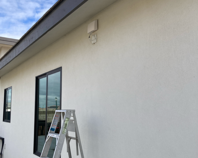
Station gallery

RBsHome, Bakersfield
55
Newest stations deployed in Bakersfield
AQI⁺ station ranking
Newest stations

Clean Air Facilities



Learn more about global air quality


Learn more about air pollution in Bakersfield
How is the air quality in Bakersfield, CA?
Bakersfield, California suffers from frequent unhealthy air quality. Until 2019, Bakersfield had failed to meet federal guidelines for 24-hour PM2.5, 24-hour ozone, and annual PM2.5 since records began around the turn of the century.1 In 2019, Bakersfield reached attainment for annual PM2.5 for the first time. The city’s air quality, however, continues to exceed standards for short-term pollution measures (24-hour PM2.5 and 24-hour ozone).
PM2.5 describes fine particulate matter suspended in the air that measures 2.5 microns or smaller. Since the size of particulates is the key identifying feature of PM2.5, it includes a mixture of particles ranging in chemical composition to include dust, dirt, soot, chemicals, aerosols, and viruses. PM2.5 is so small that when inhaled, it can easily slip past the body’s respiratory defenses and become absorbed into the circulatory system, thus contributing to far-reaching health effects. Exposure to PM2.5 has been definitively linked to adverse health effects, such as coughing, chest pain, heart arrhythmias, cancer, the development of cardiovascular disease, and early death.
In Bakersfield, PM2.5 sources include the extraction, mining, and refining of petroleum by oil and gas companies, industrial activity powered by fossil fuels, the motor transport of goods to and from distribution centers, agricultural dust, personal vehicular emissions, wood burning, and smoke from active wildfires.
The United States Environmental Protection Agency (EPA) sets standards for both short-term (24-hour) PM2.5, and annual PM2.5. These standards mandate that there should be no more than 3.2 unhealthy PM2.5 days per year, and annual PM2.5 concentrations should not exceed 12 μg/m3.
In the 3-year monitoring period from 2016 to 2018, Bakersfield averaged 35.8 unhealthy PM2.5 days a year, far exceeding the federal allowance of 3.2 days. This average was derived by weighting 64 “orange” (unhealthy for sensitive groups) pollution days and 29 “red” (unhealthy for the general public) days over the three-year period.
For annual PM2.5 pollution, Bakersfield averaged a yearly mean concentration of 11.3 μg/m3 in 2019, thus meeting the federal standard of less than 12 μg/m3. In all previous recorded years, Bakersfield failed to meet this standard. Before this year, Bakersfield averaged a PM2.5 concentration of 15.9 μg/m3 in 2018 and 16.2 μg/m3 in 2017.
The World Health Organization (WHO) uses an even more stringent guideline for annual PM2.5, suggesting that residents should be exposed to no more than 10 μg/m3 per year. By this air quality standard, Bakersfield still has a long way to go before meeting guidelines for healthy air.
Ground-level ozone is another pollutant of grave concern in Bakersfield. Ozone is a highly corrosive, highly irritating gas pollutant and key component of “smog.” Breathing ozone has been connected to health effects ranging from difficulty breathing and coughing to permanent lung damage, lung cancer, and early death.
Bakersfield averages a startling 103.2 unhealthy ozone days a year, more than 32 times the federal allowance of 3.2 days. In the 3-year monitoring period from 2016 to 2018, there were 257 unhealthy ozone days were labeled “orange” (unhealthy for sensitive groups), while 35 unhealthy ozone days were labeled “red” (unhealthy for the general public).
Such exceedances in unhealthy pollution tend to more acutely jeopardize the health of Bakersfield’s “sensitive individuals,“ including children, the elderly, and those with pre-existing heart and lung conditions. The 69,895 Bakersfield residents with asthma, 66,853 with heat and lung disease, 259,180 children under 18, and 98,347 adults over 65 are all disproportionately subject to Bakersfield’s frequent unhealthy air quality days.
A 2006 study on the effects of air pollution in the San Joaquin Valley estimated that air pollution cost the region roughly $3 billion, or roughly $1,000 per person, per year.2 The cost assumes:
- 460 early deaths among those age 30 and older
- 23,300 asthma attacks
- 188,000 days of school absences
- 3,230 cases of acute bronchitis in children
- 3,000 lost work days
- 325 new cases of chronic bronchitis
- 188,400 days of reduced activity in adults
- 260 hospital admissions
- More than 17,000 days of respiratory symptoms in children
While such estimates are concerning, it is important to note that, even in polluted environments, it is possible to breathe clean air. Follow Bakersfield’s live air quality data at the top of this page to stay up to date with current health advisories. Forecast air quality data in Bakersfield can be a useful tool for planning ahead to protect one’s home and office from spikes in air pollution and to avoid outdoor activity during a day’s most polluted hours.
Where does Bakersfield Kern County rank in the world for air pollution?
Bakersfield is frequently reputed to be the most polluted city in the United States. This designation is given by the American Lung Association’s (ALA) “State of the Air” report, which compares roughly 200 national metropolitan areas on the basis of 24-hour PM2.5, 24-hour ozone, and annual PM2.5. In its 2020 air quality report, Bakersfield ranked:
- #1 for annual particle pollution out of 203 metropolitan areas
- #2 for 24-hour particle pollution out of 217 metropolitan areas
- #3 for high ozone days out of 228 metropolitan areas
In the 2019 World Air Quality Report, which compares annual PM2.5 across a much larger sample size of 1,518 US cities, Bakersfield ranked #185, down significantly from 2018, in which the city ranked #19 out of 723 cities.
Variations year over year do little to hide the fact that Bakersfield air quality is among the worst in the US.
But comparing Bakersfield to regional and global cities, on the other hand, puts Bakersfield’s dirty air into broader perspective. For example, Bakersfield’s annual PM2.5 concentration of 11.3 μg/m3 in 2019 is a far cry from the world’s most polluted city, Ghaziabad, India, which averaged a PM2.5 concentration roughly 10 times higher (110.2 μg/m3) that same year. Out of 4,690 global cities compared here, Bakersfield ranked #2,085.
Comparing air quality across North American cities on a regional level,, Bakersfield ranked #228 out of 1725 cities. Its annual concentration is more than half that of the most polluted city in North America: Toluca, Mexico, which averaged 29.4 μg/m3 in 2019.
See the full global ranking of the world’s most polluted cities here.
Why is Bakersfield, CA so polluted?
Bakersfield’s high air pollution levels owe to the area’s high-emission industries (such as agriculture and fossil-fuel based energy production), growing residential emissions, and its geographic and climatic conditions, which cause polluted air to become trapped in the valley.3 All three play near equal parts in creating Bakersfield’s dirty air.
High-polluting industries
Bakersfield is a hub for energy production, agriculture, and distribution in California.
Foremost among polluting industries in the city is the oil and gas industry. Kern County, of which Bakersfield is the county seat, is the most productive oil-producing county in the state of California. Kern Oil, the primary oil refinery in the area, is subject to numerous Clean Air Act violations resulting from over-polluting. Since 2015 alone, Kern Oil has amassed 171 formal enforcement actions.
Bakersfield agricultural land and activity is another culprit of the city’s dirty air. Farm land machinery, crop burning, pesticides, and wind-blown dust are major sources of airborne particulates as well as gases like nitrogen dioxide, an ozone precursor pollutant.
Residential emission sources
Bakersfield is the ninth-largest city in California, with a population of 392,756, and the second-fastest growing among the state’s metropolitan areas.4 While California’s population grew by just 0.47 percent last year, the lowest rate on record, Bakersfield expanded by more than double that rate.
Residential emissions, such as those from private motor vehicles, wood stoves, fire pits and BBQs, are traditionally the largest contributor of air pollution in US cities. As more people move to Bakersfield, addressing emissions from vehicles and homes will become even more important.
Geography
Bakersfield’s location in a valley encircled by mountains, including the Sierra Nevada mountains to the east and the California Coast Ranges to the west, doesn’t do the city any favors in regards to air pollution. Its geographic location in a bowl, contributes to high-pressure systems that stagnate polluted air and prevent it from dispersing for weeks at a time. The lack of prevailing winds from the nearby Pacific also contributes to Bakersfield’s uniquely poor air quality situation, even among larger cities nearby such as Fresno.
Climate and meteorology
Bakersfield has a hot, desert-like climate that promotes the prevalence of both ozone and particle pollution.
Ozone, as a secondary pollutant, requires sunlight and warm temperatures (over 84 degrees) to form. From May through September, such warm, sunny conditions are abundant, as is ozone pollution. On average, 1 in every 3 days is an unhealthy ozone day in Bakersfield. As climate change contributes to increasingly hot temperatures, moderating ozone levels will become even more challenging.
Bakersfield is also subject to an especially dry climate, averaging just 6 inches of rainfall a year.5 This dry climate prevents particle pollution from coagulating or being tamped down by rain, and as a result, particles can remain suspended in the air for much longer than is typical.
Is air quality in Bakersfield improving?
Air quality in Bakersfield has seen little improvement over the last 20 years despite significant advancements in fuel efficiency, emission control, and clean energy.
In the last decade (from the 2009-2011 monitoring period to the most recent 2016-2018 monitoring period), the number of unhealthy ozone days has fallen just 12.4 percent, while the number of unhealthy PM2.5 days has fallen 23 percent.
These subtle improvements have come in part as a result of regulations discouraging farmers from burning their agricultural waste, funding trade-ins for old farm equipment, the gradual transition of residents to more fuel-efficient vehicles, and enforcing new standards for fireplaces and furnaces.
Still, some believe that the “worst air in the United States” may be getting worse. Regulatory rollbacks on high-emitting industry initiated by the Trump administration, climate change, increasingly severe and frequent California wildfires, and a growing population all pose challenges to achieving sustained reductions and meeting federal air quality targets.
Are all areas of Bakersfield polluted?
Air quality varies location to location due to proximity to emission sources and as a result of dynamic meteorological and geographical conditions. Within a city, however, ambient air quality tends to be relatively consistent in that residences up to 30 miles away from one another often experience pollution levels within a deviation of 10 percent.
In Bakersfield, an agricultural and oil industry hub, hyperlocal variations are more common. Locations closer in proximity to major petroleum extraction or refinement facilities, for example, are more likely to experience high pollution levels than those further removed.
Cities up to roughly 100 miles away from Bakersfield also experience similar air quality trends – some even reported worse air quality than Bakersfield in 2019.
Bakersfield averaged a PM2.5 concentration of 11.3 μg/m1 in 2019, and 15.9μg/m3 in 2018. Neighboring cities, meanwhile, averaged:
- Visalia air quality (68 miles away): 12.8 μg/m3 in 2019, 17.6 μg/m3 in 2018.
- Los Angeles air quality (101 miles away): 12.7 μg/m3 in 2019, 14.4 μg/m3 in 2018.
- Fresno air quality (106 miles away): 12 μg/m3 in 2019, 14 μg/m3 in 2018.
All four cities exceeded the World Health Organization target for annual PM2.5 exposure (10 μg/m3) in 2017, 2018, and 2019. Moreover, November and December were the most polluted months for each.
Use the Bakersfield air quality map to understand variations in air quality across locations. See how weather patterns, such as wind direction and speed, can affect pollution levels across the city, lowering air quality in some locations and exacerbating it in others.
+ Article Resources
[1] American Lung Association. (2020). State of the air – 2020.
[2] California State University, Fullerton College of Business and Economics (2006). Air Pollution costs San Joaquin Valley $3 billion a year.
[3] Berg N. (2017, Feburary 14). Breathless in Bakersfield: Is the worst air pollution in the US about to get worse? The Guardian.
[4] California Department of Finance. (2020, May 1). California tops 39.8 million residents at new year per new State demographic report.
[5] California Nevada River Forecast Center – National Oceanic and Atmospheric Administration (NOAA). (2020, March 18). Climate station precipitation summary. National Weather Service.


